SOUTH AFRICA:100. Merian, Matthaeus. 'AETHIOPIA INFERIOR VEL EXTERIOR
MONOMOTAPA'. Map of South Africa with large figurative cartouche and sailing ships. Engraved by Merian and published by Johann Ludwig Gottfried in Frankfurt 1646 [7203] 29 x 37 cm. Brown brush smudge in lower middle left image, otherwise very good condition. £150
|
 |
EAST and CENTRAL AFRICA:101. Merian, Matthaeus.
'AETHIOPIA SUPERIOR VEL INTERIOR VULGO ABISSINORUM SIVE PRESBITERIIOANNIS
IMPERIUM'. Map of Central and Eastern Africa, incl. Ethiopia, Somalia, Kenya, Uganda and Tanzania, with figurative cartouche and scale of miles. Engraved by Merian and published by Johann Ludwig Gottfried in Frankfurt 1650 [14550] 29 x 37 cm. Excellent condition. £100
Uncoloured as originally published. |
 |
ALGIERS:102. Merian, Matthaeus. ‘ALGIER’. Half birds-eye plan / view of Algiers with fortifications and
harbour. Engraved by Merian and published by Johann Ludwig Gottfried in Frankfurt 1646 [20032] 22 x 34 cm. Excellent condition. £100
Uncoloured as originally published. |
 |
MOROCCO:103. Merian, Matthaeus. ‘FEZZAE ET MAROCCHI REGNA AFRICAE CELEBERRIMA’. Map of Morocco with figurative title cartouche and sailing ships. North orientated to the right. Engraved by Merian and published by Johann Ludwig Gottfried in Frankfurt 1646 [20074] 26 x 33 cm. Excellent condition. £120
Uncoloured as originally published. |
 |
�ANGOLA - NAMIBIA:104. Reinecke, J. C. M. ‘CHARTE VON NIEDER GUINEA UND DEN ANGRENZENDEN LÄNDERN SÜD-AFRICAS...’. Antique map of the African southwest coast, showing Angola and Namibia. Johann Christoph Matthias Reinecke for Verlag des Geograph. Instituts Weimar 1817 [25846] 42 x 47 cm. Original outline colour. Excellent condition. £100
|
 |
CAIRO:105. Brewer, J. W. ‘PANORAMIC VIEW OF CAIRO’. A superb prospect of Cairo with the Mosque of the Citadel, built in Alabaster by Mohammed Ali, in the
centre. Also in the picture is the Mosque of Sultan Hassan, Joseph’s Well, Citadel and Palace and in the background, the Nile. Drawn and engraved by J. W. Brewer for The Graphic 1882 [21698] 25 x 124 cm. Uncoloured. Issued as a supplement. Folded. Very good condition. £150
|

 |
CAIRO:106. The Graphic. ‘BIRDS EYE VIEW OF CAIRO LOOKING NORTH EAST’. The pyramids and Sphinx in the foreground. Special chromolithograph supplement to The Graphic 1882 [23280] 39 x 55 cm. Printed in tone colours. Very good condition. £120
|
 |
CAPE VERDE ISLANDS:107. Du Val, P. ‘ISLES DU CAP VERD’. Small map of the Cape Verde Islands. Pierre Du Val 1663 [21196] 10 x 12 cm. Original outline colour. Excellent condition. £90
|
 |
CAPE VERDE ISLANDS:108. Janssonius, J. / Schenk, P. & Valk, G. ‘INSULAE DE CABO VERDE OLIM HESPERIDES SIVE
GORGADES...’. Sea chart of the Cape Verde Islands with large decorative cartouche. Published by Pieter Schenk and Gerard Valk from the plate by Joannes Janssonius ca. 1700 [22073] 43 x 54 cm. The map in full original colour. Excellent condition. £300
|
 |
|
CAPE VERDE ISLANDS:109. Bellin, N. ‘KARTE VON DEN EYLANDEN DES GRÜNEN VORGEBÜRGES’. Antique map of the Cape Verde Islands. Nicolas Bellin 1747 [19191] 21 x 28 cm.
Full hand colour. Excellent condition. £120
|
 |
CAPETOWN:110. Anonymous. ‘CAPE TOWN, CAPE OF GOOD HOPE, RECENTLY VISITED BY HIS ROYAL HIGHNESS THE DUKE OF EDINBURGH’. Panoramic view of the city with the mountains beyond. Illustrated London News 1867 [26937] 15 x 51 cm.
Full hand colour. Excellent condition. £120
|
 |
DIAMOND MINES:111. Anonymous. ‘THE DIAMOND DIGGINGS, SOUTH AFRICA’. Many labourers and supervisors going about their work around the main diamond mine. Supplement to the Illustrated London News 1872 [23176] 31 x 48 cm. Full superb recent colour. Excellent condition. £120
|
 |
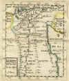
EGYPT:113. Du Val, P. ‘EGYPTE’. Small map of Egypt, together with a separate one page leaf of an heraldic shield depicting three snakes. Pierre Du Val 1663 [21185] 12 x 10 cm. Original outline colour. Excellent condition. £50
|
 |
EGYPT:115. Cary, J. ‘A NEW MAP OF EGYPT...’. Antique map of Egypt, reaching south to
Assuan, with large inset map of the Nile delta from Cairo to the Sea. John Cary 1805 [26169] 48 x 53 cm. Full original colour. Excellent condition. £160
|
 |
EGYPT:116. Hall, S. ‘EGYPT’. Sidney Hall 1829 [19277] 51 x 41 cm. Original outline Colour. Excellent condition. £100
|
 |
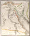
EGYPT:117. Lizars, W. ‘EGYPT’. Detailed doublepage map of Egypt. W. Lizars ca. 1845 [18968] 49 x 40 cm. Original outline colour. Excellent condition. £75
|
 |
GUINEA - NIGERIA:119. Janssonius, J. / Schenk, P. & Valk, G. ‘GUINEA’. Decorative map of the western coast of Africa from Guinea to Nigeria. Published by Pieter Schenk and Gerard Valk from the plate by Joannes Janssonius ca. 1700 [22067] 38 x 51 cm Cartouche with natives and monkeys, sailing ships, compass roses, two boys carrying a tusk (all uncoloured), the map in full original colour. Excellent condition. £275
As issued, in its original state, no later colour added to cartouches etc. |
 |
|
NORTH AFRICA:124. Reinecke, J. C. M. ‘CHARTE DER NORDKÜSTE AFRICAS ODER DIE STAATEN
MAROCCOS, FES, ALGIER, TUNIS, TRIPOLI, UND AEGYPTEN...’. North African coast, printed in two separate parts above each other on one sheet. Johann Christoph Matthias Reinecke for Verlag des Geograph. Instituts Weimar 1804 [25843] 47 x 54 cm. Original outline colour. Excellent condition. £100
|
 |
RIVER NILE:125. The Graphic. ‘CAIRO TO KHARTOUM’. Long detailed panorama of the River Nile from Cairo to Khartoum. Two views and forty-nine vignettes. Supplement with The Graphic 1884 [25762] 17 x 360 cm.
Full hand colour. Folded as issued. Excellent condition. £150
|

 |
SOUTH AFRICA:127. Reinecke, J. C. M. ‘CHARTE DER SÜDSPITZE AFRICAS UND DER COLONIE VOM VORGEBIRGE DER GUTEN
HOFFNUNG...’. Antique map of South Africa with much land unknown. Johann Christoph Matthias Reinecke for Verlag des Geograph. Instituts Weimar 1817 [25848] 39 x 59 cm. Original outline colour. Excellent condition. £100
|
 |
SOUTH AFRICA:128. Hall, S. ‘SOUTHERN AFRICA’. Sidney Hall 1828 [19271] 41 x 51 cm. Original outline Colour. Excellent condition. £150
|
 |
SOUTH AFRICA:129. Walker, J. & C. 'SOUTH AFRICA'. Antique map of South Africa with inset maps of
Capetown, the environs of Capetown, District of George, and the environs of
Grahamtown. J. & C. Walker for S.D.U.K. 1834 [7207] 32 x 39 cm. Original outline colour. Excellent condition. £75
|
 |
STANLEY’S EXPLORATION:133. Johnston, A. K. ‘MR H. M. STANLEY’S EXPLORATIONS IN THE DARK CONTINENT - MAP OF THE ROUTE AND A PORTRAIT GROUP OF THE OFFICERS OF HIS EXPEDITION’. Nine portraits in oval form and a map (15 x 51 cm). Drawn for The Graphic by Alexander Keith Johnston 1887 [23284] 35 x 51 cm. Original coloured woodengraving. Excellent condition. £150
|
 |
WEST AFRICA:135. Reinecke, J. C. M. ‘CHARTE VON
SENEGAMBIEN, NIGRITIEN UND GUINEA...’. Antique map of the African west coast with the Gulf of Guinea between Senegal and Nigeria. Small inset map of Cape Verde Islands. Johann Christoph Matthias Reinecke for Verlag des Geograph. Instituts Weimar 1817 [25845] 43 x 54 cm. Original outline colour. Minute rust stain in the centre, otherwise very good condition. £150
|
 |
WEST AFRICA:136. Hall, S. ‘WESTERN AFRICA’. Western Africa between Senegal and Congo. Sidney Hall 1829 [19270] 41 x 51 cm. Original outline Colour. Excellent condition. £100
|
 |