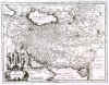
PERSIA, AFGHANISTAN and PAKISTAN:414. Merian, Matthaeus. ‘PERSIA SIVE SOPHORUM REGNUM’. Map of Persia, Afghanistan and Pakistan. Engraved by Merian and published by Johann Ludwig Gottfried in Frankfurt 1646 [20072] 26 x 34 cm. Excellent condition. £150
Uncoloured as originally published. |
 |
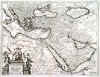
ARABIA, PERSIA and TURKEY:415. Merian, Matthaeus. ‘TURCICUM IMPERIUM . TÜRCKISCHE REYCH’. Map of Arabia, Egypt, Persia and Turkey. Large figurative cartouche. Engraved by Merian and published by Johann Ludwig Gottfried in Frankfurt 1646 [20141] 27 x 36 cm. Excellent condition. £350
Uncoloured as originally published. |
 |
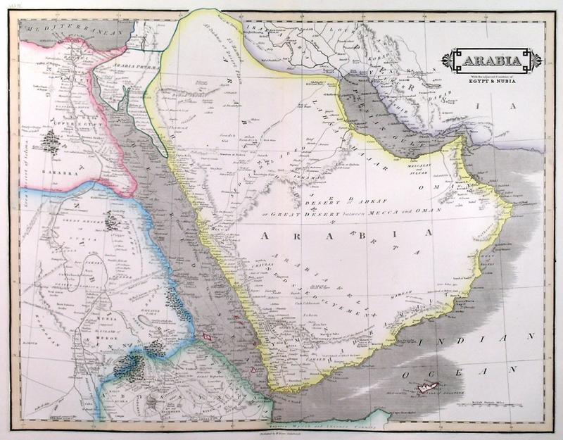
ARABIA:416. Lizars, W. ‘ARABIA’. Map of Arabia with the adjacent countries of Egypt and
Nubia. William Lizars ca. 1845 [18973] 39 x 50 cm. Original outline
colour. Excellent condition. £250
|
 |
ARABIA, PERSIA and MEDITERRANEAN:417. Senex, J. / G. De L’Isle. ‘A MAP OF
TURKY, ARABIA AND PERSIA’. Map of Arabia, Persia, Turkey, Black and Caqspian Sea, the Mediterranean and Egypt by Guillaume de L’Isle, revised and published in "A New General Atlas of the World" by John Senex ca. 1720 [28497] 47 x 57 cm. Contemporary outline
colour. Excellent condition. £450
Pictorial cartouche
(uncoloured). - The Kingdoms of ‘Bahrein’ and ‘Oman’ are shown. |
 |
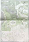
KHOR MUSA / IRAN:418. Admiralty Charts. ‘PERSIAN GULF - KHOR MUSA’. Deatiled sea chart of the bay of Khor Musa
on the Iran - Iraq border with three inset charts of Khor
Mashur, The Bar at Khor Musa and Bandar Shapur, from the latest information in the Hydrographic Department to 1948. Published under the Superintendence of Rear Admiral A. G. N. Wyatt by the Admiralty 1948 [26439] 99 x 66 cm. Uncoloured with overall olive tint. Excellent condition. £100
|
 |
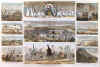
MECCA:419. Anonymous. ‘THE PILGRIMAGE TO MECCA’. View of Mecca, showing the Kaaba and the Great Mosque, surrounded by ten further images of scenes connected to Mecca and the Hajj. Double page wood engraving, published by Harper’s Weekly 1865 [29881]
35 x 52 cm. Full recent hand
colour. Excellent condition £280
Uncommon antique Islamic Pilgrimage scenes. |
 |
|
|