�AUSTRALIA:493. Johnston, A. K. ‘AUSTRALIA’. A. K. Johnston, dated 1843 [23680] 50 x 60 cm. Original outline
colour. Excellent condition. £120
|
 |
AUSTRALIA:494. Johnston, A. K. ‘AUSTRALIA’. A. K. Johnston ca. 1850 [22773] 50 x 60 cm. Original outline
colour. Excellent condition. £120
|
 |
AUSTRALIA:496. Weller, E. ‘AUSTRALIA’. Antique map of Australia. For Weekly Dispatch Atlas engraved by Edward Weller ca. 1863 [25516] 30 x 43 cm. Original outline
colour. Excellent condition. £100
|
 |
AUSTRALIA and POLYNESIA:498. Streit, F.W. ‘AUSTRALIEN NACH DEN NEUESTEN HÜLFSMITTELN ENTWORFEN’. Australia, New Zealand and Polynesia, reaching to Hawaii. Drawn by Arno Streit after Friedrich Wilhelm Streit 1834 [20105] 38 x 45 cm. Original outline
colour. Excellent condition. £160
|
 |
AUSTRALIA and POLYNESIA:499. Stieler, A. ‘AUSTRALIEN’. Australia and Polynesia, incl. Hawaii. Ad. Stieler after Krusenstern for Stieler’s Atlas 1835 [16662] 30 x 38 cm. Original outline
colour. Excellent condition. £100
|
 |
AUSTRALIA and POLYNESIA:500. Andriveau-Goujon, J. ‘CARTE DE L’OCÉANIE...’. Antique map of Australia, East India Islands and Polynesia incl. Hawaii. Inset map of New South Wales. J. Andriveau-Goujon 1845 [20486] 39 x 50 cm. Original outline
colour. Excellent condition. £100
|
 |
AUSTRALIA and POLYNESIA:501. Meyer, J. 'NEUESTE KARTE VON
AUSTRALIEN'. Antique map of Australia ('Neu Holland'), Indonesia and part of the South Pacific and New Zealand, with inset maps of Tasmania, Western Australia and New South Wales. Radefeld for Meyer 1846 [7542] 31 x 37 cm. Original outline
colour. Excellent condition. £100
|
 |
AUSTRALIA and POLYNESIA:502. Völter, D. ‘AUSTRALIEN’. Antique map of Australia and Polynesia. Four small inset maps of West Australia, New South Wales, Tasmania and South Australia. Daniel Völter ca. 1853 [17367] 26 x 36 cm. Original outline
colour. Some slight occasional browning, otherwise very good condition. Uncommon. £125
|
 |
FIJI ISLANDS:503. Admiralty Charts. ‘KANDAVU ISLAND. NGALOA BAY’ and ‘VITI
LEVU. MBAU ROADS’. Two sea charts of Fiji Island bays in the South Pacific on one sheet. Published under the Superintendence of
Captn. G. H. Richards at the Admiralty 1868 [26433] 42 x 65 cm.
Uncoloured. Two small marginal tears closed, otherwise excellent condition. £120
|
 |
NEW SOUTH WALES:505. Johnston, A. K. ‘COLONY OF NEW SOUTH WALES AND AND AUSTRALIA FELIX’. Antique map of New South Wales and Victoria. A. K. Johnston 1843 [22772] 50 x 61 cm. Original outline
colour. Excellent condition. £180
|
 |
NEW SOUTH WALES:506. Flemming, C. 'NEU SÜD-WALES'. Antique map of New South Wales divided into 19 land districts. Carl Flemming in Glogau ca. 1850 [7551] 39 x 32 cm. Inset plan of Sydney. Original outline
colour. Excellent condition. £100
|
 |
NEW SOUTH WALES:507. Johnston, A. K. ‘COLONY OF NEW SOUTH WALES AND VICTORIA’. The Gold Diggings are coloured Yellow. Also indicated are the excursions by Major Mitchell to the Rivers Darling & Murrey in 1836. The Australian Alps & Gipps Land were explored by Count Streletsky in 1840. The new Colony of Victoria comprising the districts of Australia Felix, Port Phillip, & Gippsland were proclaimed in 1848. A. K. Johnston ca. 1850 [25766] 50 x 61 cm. Original outline
colour. Excellent condition. £240
|
 |
NEW SOUTH WALES:508. Tallis, J. 'NEW SOUTH WALES'. Antique map of New South Wales in Australia. John Tallis ca. 1851 [26458] 34 x 25 cm. Original outline
colour, all vignettes and border recent colour. Excellent condition. Folio edition - no
centrefold. £160
|
 |
|
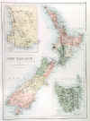
NEW ZEALAND:512. Hughes, W. ‘NEW ZEALAND’. Antique map of New Zealand with small inset maps of Tasmania and Western Australia. W. Hughes for A. & C. Black ca. 1853 [15944] 38 x 27 cm. Full original
colour. Excellent condition. £125
|
 |
NEW ZEALAND:516. Stanford, E. ‘NEW ZEALAND’. A detailed map towards the end of the 19th century. Edward Stanford ca. 1894 [24416] 60 x 47 cm. Full original
colour. Excellent condition. £120
|
 |
PACIFIC:519. Thomas, Cowperthwait & Co. ‘THE PACIFIC OCEAN INCLUDING
OCEANICA...’. Antique map of the Pacific Ocean with inset map of the Sandwich or Hawaiin Islands and smaller inset of the Antarctic. Thomas and Cowperthwait in Philadelphia for Mitchell ca. 1850 [24629] 32 x 40 cm. Full original
colour. Excellent condition. £90
|
 |
PACIFIC:520. Johnston, A. K. ‘OCEANIA’. Very detailed doublepage map of Australia, New Zealand and Islands in the South Pacific towards the end of the 19th century, with insets of Western Australia, Tasmania, the eastern extremity of New Guinea, and the Fiji Islands. W. & A.K. Johnston 1893 [25288] 44 x 57 cm. Original outline
colour. Excellent condition. £90
|
 |
POLYNESIA:522. Tallis, J. 'POLYNESIA, OR ISLANDS IN THE PACIFIC OCEAN'. Antique map of the South Pacific. John Tallis ca. 1851 [26469] 25 x 35 cm. Original outline
colour, all vignettes and border recent colour. Excellent condition. £90
|
 |
TASMANIA:529. Johnston, A. K. ‘VAN DIEMEN’S LAND OR TASMANIA’. Very detailed map of Tasmania. A. K. Johnston ca. 1850 [23678] 60 x 50 cm. Original outline
colour. Excellent condition. £75
|
 |
WESTERN and SOUTH AUSTRALIA:530. Weller, E. ‘WESTERN AUSTRALIA’ and ‘SOUTH AUSTRALIA’. Two maps on one sheet. For Weekly Dispatch Atlas engraved by Edward Weller ca. 1863 [17189] 30 x 42 cm. Original outline
colour. Excellent condition. £70
|
 |
|