|
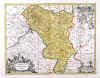
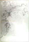
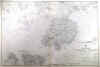
ALDERMASTON COURT ESTATE:531. Wing, W. ĎPLAN OF THE ALDERMASTON COURT ESTATE IN THE PARISHES OF
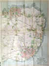
ALDERMASTON, PADWORTH & MORTIMER, BERKSHIRE. FOR SALE BY MESSRS. SIMMONS & SONS, 1893í. Very large detailed sales plan for the whole estate reaching around Aldermaston from River Kennet to Pamber Heath. Privately published by the estate agents after a survey by W. Wing and printed by H. E. Greenslade in Reading 1893 [29588] 96†x†60†cm. Previously folded. Printed in soft one-tone
colours. Very good condition. £450
Aldermaston Manor was built in 1851 in place of the previous Manor House, which was destroyed by fire. In 1985 the Aldermaston Park site was bought by Blue Circle Industries and the House converted into a hotel and conference
centre. Again in 2014 the site and house were bought by a property investment company with planning permission to add more offices. - It is very unlikely that many or any of these sales plans have survived. |
 |
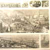
BIRMINGHAM:532. Brewer, H. W. ĎBIRDíS - EYE VIEW OF BIRMINGHAM IN 1886í. Legend and key below main picture. School of Art, Town Hall and the Council House in the centre foreground. Drawn by H. W. Brewer for The Graphic 1886 [21516] 50 x 65 cm. Uncoloured as issued. Excellent condition. £250
|
 |
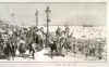
BRIGHTON:533. Durand, G. ĎHOLIDAY TIME AT THE SEASIDE - THE MIDDAY - PROMENADE IN FRONT OF THE KINGíS ROAD, BRIGHTONí. View of Brighton along the beach. Drawn by G. Durand for The Graphic 1892 [21517] 34 x 110 cm. Uncoloured as issued. Folded. Excellent condition. £180
|

 |
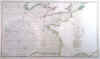
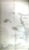
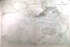
BRITISH CHANNEL - BAY OF BISCAY:534. Faden, W. / LíAbbé Diquemare and
L. S. De La Rochette. ĎA CHART OF THE BRITISH CHANNEL AND THE BAY OF BISCAY, WITH A PART OF THE NORTH SEA, AND THE ENTRANCE OF ST. GEORGEíS CHANNELí. Sea chart of the British Channel, the Bay of Biscay and the Western Atlantic, with an extension showing the tracks of the encounter of the British and French fleets in May 1794. After LíAbbé Diquemare and
L.S. De la Rochette engraved and published by William Faden 1794 [27793] 51†x†88†cm. Original outline
colour. Excellent condition. £250
Admiral of the Fleet Richard Howe, 1st Earl Howe KG (1726Ė99) was a British naval officer, best known for his command of the British fleet during the ĎGlorious First of Juneí in 1794, which is recorded in this specially extended edition of the chart. |
 |
|
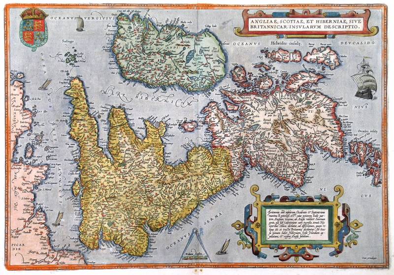
BRITISH ISLES:535. Ortelius, A. ĎANGLIAE, SCOTIAE, ET
HIBERNIAE, SIVE BRITANNICAR: INSULARUM DESCRIPTIOí. Map of the British Isles, North orientated to the right. Two cartouches and heraldic shield. From the Latin text edition of the Theatrum Orbis Terrarum by Abraham Ortelius ca. 1592 (- 1612) [28544] 34†x†49†cm. Full contemporary
colour. Excellent condition. £975
van den Broecke 16. |
 |
|
BRITISH ISLES:535A. De Wit, Fr. ĎNOVA TOTIUS ANGLIAE, SCOTIAE, ET HIBERNIAE TABí. Map of the British Isles with figurative cartouche and banner with armorial shields. Published by Frederick de Wit in Amsterdam ca. 1675 [29715] 48†x†56†cm. No text verso. Full original
colour. Excellent condition. £350
Shirley/British Isles p. 155. |
 |
|
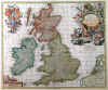
BRITISH ISLES:536. Visscher, N. ĎMAGNAE BRITANNIAE TABULA...í. Highly decorative map of the British Isles with large figurative title cartouche, three coats of arms surrounded by
putti, and scale of miles. Nicolaas Visscher ca. 1680 [28526] 47†x†56†cm. Full contemporary hand
colour, incl. cartouches and shields. Excellent condition. £450
|
 |
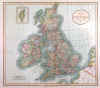
BRITISH ISLES:537. Cary, J. ĎA NEW MAP OF THE BRITISH ISLES ...í. Map of the British Isles with Ireland. John Cary 1807 [26196] 46†x†52†cm. Full original
colour. Excellent condition. £100
|
 |
|
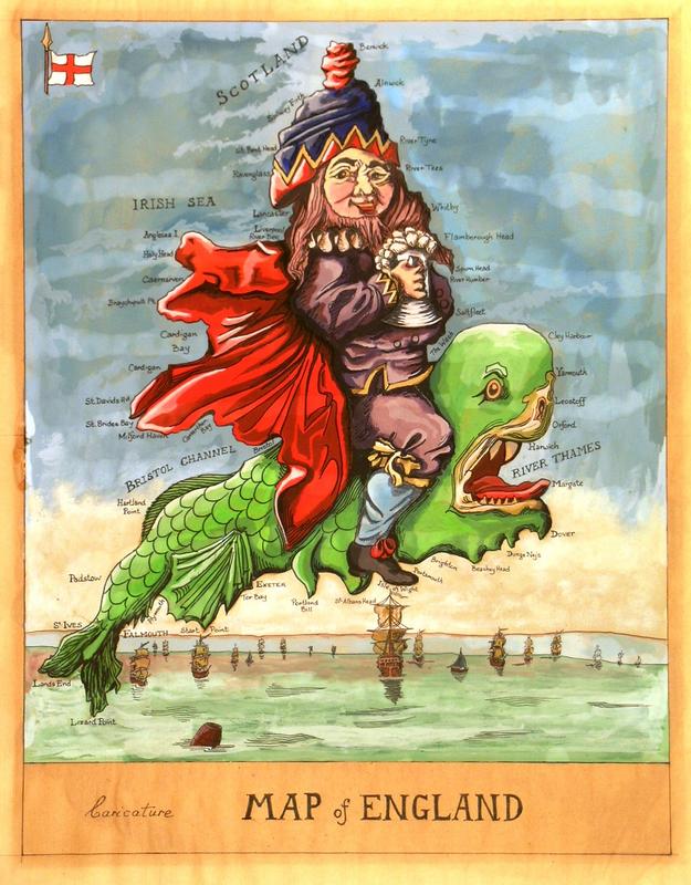
CARICATURE WATERCOLOUR MAP OF ENGLAND & WALES:541. Anonymous. ĎCARICATURE MAP OF ENGLANDí. Large watercolour caricature
map of |England and Wales, drawn by a competent hand after (but much larger than) the earlier printed map by Robert Dighton (ĎGeography Bewitched!...í). Anonymous ca. 1950 [27383] 44†x†34†cm. Painted on verso of a sheet of old wallpaper in vivid gouache colours and laid down on board. Excellent condition. £450
|
 |
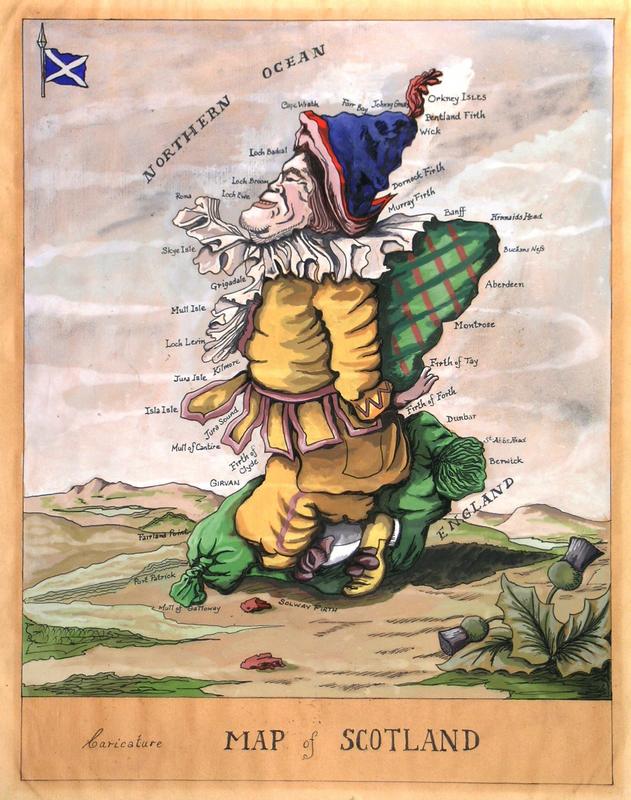
CARICATURE WATERCOLOUR MAP OF SCOTLAND:542. Anonymous. ĎCARICATURE MAP OF SCOTLANDí. Large watercolour caricature map of Scotland, drawn by a competent hand after (but much larger than) the earlier printed map by Robert Dighton (ĎGeography Bewitched!...í). Anonymous ca. 1950 [27384] 44†x†34†cm. Painted on verso of a sheet of old wallpaper in vivid gouache colours and laid down on board. Excellent condition. £350
|
 |
|
DERBYSHIRE:546. Janssonius, J. / Schenk, P. & Valk, G. ĎCOMITATUS DARBIENSISí. Antique map of Derbyshire with cartouche, scale of miles and 5 coats of arms supported by cherubs. Published by Pieter Schenk and Gerard Valk from the plate by Joannes Janssonius ca. 1700 [21820] 38†x†48†cm. Cartouches and coats of arms
uncoloured, the map in full original colour. Excellent condition. £150
|
 |
EDINBURGH:547. Merian, Matthaeus. ĎEDYNBURGUMí. Panoramic view of Edinburgh in Scotland with small coat of arms in the sky. Engraved by Merian and published by Johann Ludwig Gottfried in Frankfurt 1646 [20061] 20†x†35†cm. Excellent condition. £225
Uncoloured as originally published. |
 |
BRITISH ISLES:548. Merian, Matthaeus. ĎMAGNAE BRITANNIAE ET HIBERNIAE
TABULAE. DIE BRITANNISCHEN INSULEN.í Map of Great Britain and Ireland with title cartouche, heraldic shield and small inset map of the Orkney Islands. Engraved by Merian and published by Johann Ludwig Gottfried in Frankfurt 1646 [10543] 27†x†35†cm. Excellent condition. £250
Uncoloured as originally published. |
 |
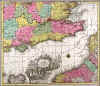
ENGLAND & WALES:549. De Wit, F. ĎANGLIA REGNUM IN OMNES SUOS
DUCATUS, COMITATUS, ET PROVINCIAS DIVISUMí. Map of England and Wales with coat of arms supported by sea maidens and dolphins. Frederic de Wit ca. 1685 [21791] 58†x†48†cm.
Uncoloured. Excellent condition. £150
Shirley II, p.156. |
 |
|
ENGLAND & WALES:550. Chatelain, H. A. ĎNOUVELLE CARTE DíANGLETERRE...í. Antique map of England and Wales with a small inset map of Northumberland. Extensive tables of references to both sides. Henry Abraham Chatelain ca. 1720 [19477] 47†x†62†cm.
Full hand colour. Excellent condition. £120
|
 |
|
ENGLAND & WALES:551. Cary, J. ĎA NEW MAP OF ENGLAND...í. Map of England and Wales. John Cary 1807 [26152] 45†x†52†cm. Full original
colour. Some brown spotting to top left image, otherwise very good condition. £100
|
 |
|
ENGLAND & WALES:552. Stieler, A. ĎCHARTE VON ENGLAND...í. Map of England and Wales divided into counties. Adolph Stieler for Verlag des Geograph. Instituts Weimar 1817 [25824] 47†x†54†cm. Original outline
colour. Excellent condition. £100
|
 |
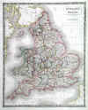
ENGLAND & WALES:553. Hall, S. ĎENGLAND AND WALESí. Antique map of England and Wales Sidney Hall 1828 [19287] 51†x†41†cm. Original outline
colour. Excellent condition. £100
|
 |
|
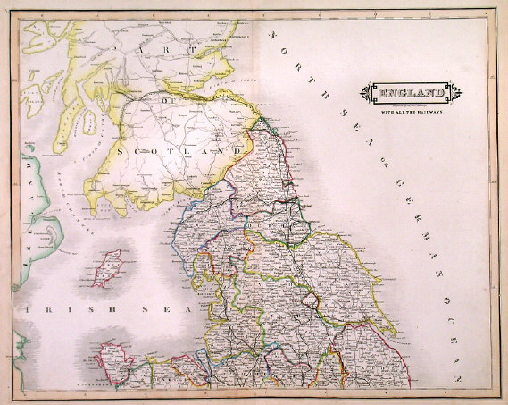
ENGLAND & WALES:554. Lizars, W. ĎENGLAND WITH ALL THE RAILWAYSí. Large map of England and Wales, printed on two double sheets. W. H. Lizars ca. 1845 [20664] 81†x†52†cm when joined. Original outline
colour. Excellent condition. The two map sheets £90
|

 |
ENGLAND & WALES COACH ROADS:557. Coltman, N. ĎLAURIE AND WHITTLEíS NEW MAP OF ALL THE COACH ROADS, BOTH DIRECT AND CROSS, OF ENGLAND & WALES, WITH THOSE OF SCOTLAND TO THE SOUTH OF EDINBURGH AND GLASGOWí. Folding map of England and Wales, showing the coach roads, dissected into 20 segments and laid down on linen. Drawn by Nathaniel Coltman and published by Robert Laurie and James Whittle 1809 [26210] 78†x†63†cm, folding into original slipcase. Original outline
colour. Excellent condition. £300
Slipcase slightly worn. |
 |
|
ENGLISH CHANNEL:560. Visscher, N. / Schenk, P. ĎMANICA, GALLIS LA
MANCHE, ET BELGIS HET CANAAL, PARS OCEANI INTER ANGLIAM ET GALLIAM...í.Sea Chart of the English Channel, coastal areas and ports of southern England, Bretagne and
Normandie. Figurative cartouche and two compass roses. Published by Pieter Schenk junior from the plate by Nicolaas Visscher ca. 1720 [21844] 48†x†57†cm. The map in full original
colour. Excellent condition. £300
|
 |
ENGLISH CHANNEL:562. Lotter, T. C. ĎLA PLUS GRANDE PARTIE DE LA MANCHE QUI CONTIENT LES CÔTES DíANGLETERRE ET CELLES DE FRANCE...í. Southeast England, the Channel and parts of the French and Belgian coast. Tobias Conrad Lotter in Augsburg ca. 1770 [20108] 49†x†57†cm. Full original
colour, the large highly decorative cartouche uncoloured. Excellent condition. £300
|
 |
ENGLISH CHANNEL:563. Admiralty Charts. ĎENGLISH CHANNEL - WESTERN PORTIONí. Sea chart of the English Channel from the Isle of Wight and Cherbourg to the West, from the latest information in the Hydrographic Department to 1955 published under the Superintendence of Commodore K. St. B. Collins, and now with latest corrections by the Admiralty 1957 [26810] 66†x†99†cm.
Uncoloured. Occasional slight browning, otherwise excellent condition. £100
|
 |
|
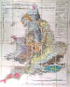
GEOLOGY - ENGLAND & WALES:564. Bacon, G. W. ĎGEOLOGICAL MAP OF ENGLAND & WALESí. Folding geological map, dissected into 20 segments and laid down on linen. G. W. Bacon ca. 1880 [29550] 62†x†50†cm, folding into original boards. Full original
colour. Excellent condition. £200
|
 |
|
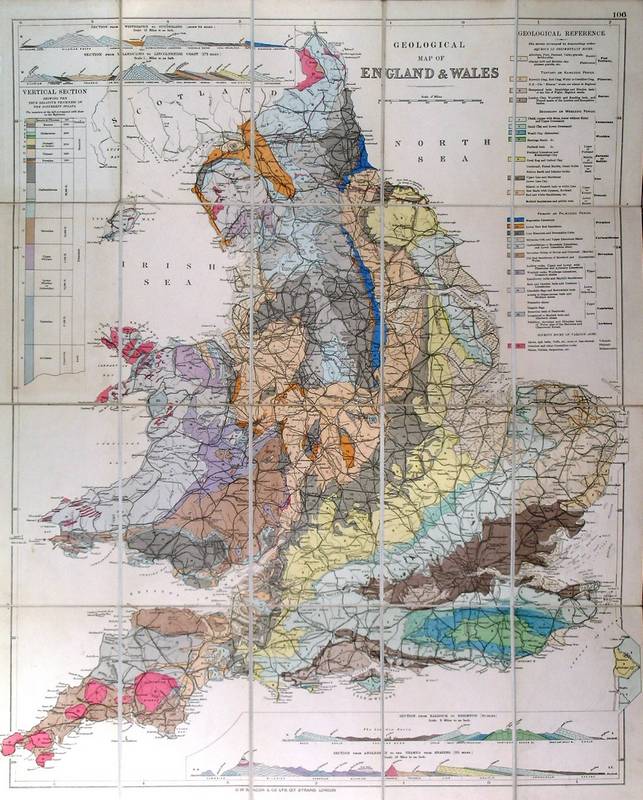
GEOLOGY - ENGLAND & WALES:566. Anonymous. ĎGEOLOGICAL MAP OF ENGLAND & WALESí. Geological map of England and Wales, printed in colours on two sheets and joined. Anonymous ca. 1890 [25641] 62†x†48†cm. Full original
colour. Excellent condition. £200
|
 |
GLASGOW:568. Brewer, H. W. ĎGLASGOWí. View from the tower of the Central Hotel. An excellent panorama of Glasgow, surrounded by ten views. Engraved by H. W. Brewer for The Graphic 1888 [24764] 68†x†111†cm. Uncoloured as issued. Laid on Linen Very good condition. £350
|

 |
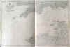
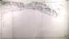
HAMPSHIRE - SUSSEX COAST:570. Depot de la Marine. ĎANGLETERRE (CÔTE
SUD) DE PORTSMOUTH A BEACHY HEADí. Doublepage detailed seachart of the Hampshire / Sussex coast between Portsmouth / Isle of Wight, Brighton, and Eastbourne
(Beachy Head), the soundings given in metres and the position of various lighthouses indicated in yellow/red. Engraved by L. Grenier after Vialard for Depot des Cartes et Plans de la Marine 1865 [26396] 44†x†65†cm.
Uncoloured, except for surrounds and lighthouses. Small paper cut-out to top white margin (not affecting image), otherwise very good condition. £200
|  |
HEREFORD:571. Janssonius, J. / Schenk, P. & Valk, G. ĎHEREFORDIA COMITATUS VERNACULE HEREFORDSHIREí. Antique map of Hereford in Wales with two cartouches and 7 coats of arms. Published by Pieter Schenk and Gerard Valk from the plate by Joannes Janssonius ca. 1700 [21815] 37†x†49†cm. Full original
colour, cartouches and coats of arms uncoloured. Excellent condition. £150
As issued, in its original state, no later colour added to cartouches etc. |
 |
|
HERTFORDSHIRE:572. Kitchin, Th. ĎA NEW IMPROVED MAP OF HARTFORDSHIRE FROM THE BEST SURVEYS...í. Large map of Hertfordshire with pictorial cartouche and dedication cartouche. Thomas Kitchin ca. 1787 [27023] 53†x†66†cm. Original outline
colour. Excellent condition. £120
From Bowen & Kitchin / The Large English Atlas. |
 |
|
HUNTINGDONSHIRE:573. Janssonius, J. / Schenk, P. & Valk, G. ĎHUNTINGDONENSIS COMITATUS HUNTINGTON SHIREí. Antique map of Huntingdonshire with figuraive cartouche and 15 coats of arms. Published by Pieter Schenk and Gerard Valk from the plate by Joannes Janssonius ca. 1700 [22782] 38†x†48†cm. Cartouche and coats of arms
uncoloured, the map in full original colour with some recent additions. Excellent condition. £120
|
 |
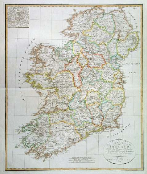
IRELAND:576. Geograph. Institut Weimar. ĎCHARTE VON IRELAND...í. Map of Ireland with small inset plan of the lakes of Killarney. Verlag des Geograph. Instituts Weimar 1817 [25826] 56†x†47†cm. Original outline
colour. Excellent condition. £125
|
 |
|
IRELAND:579. Swanston, G. H. ĎIRELANDí. Antique map of Ireland. Engraved by G. H. Swanston and published by Archibald Fullarton ca. 1850 [26835] 51†x†41†cm. Original outline
colour. Excellent condition. £100
|
 |
KENT:581. Cary, J. / Stockdale, J. ĎA MAP OF KENT FROM THE BEST AUTHORITIESí. Engraved by J. Cary after E. Noble and published by John Stockdale 1805 [20909] 34 x†51 cm. Original outline
colour. Excellent condition. £120
|
 |
|
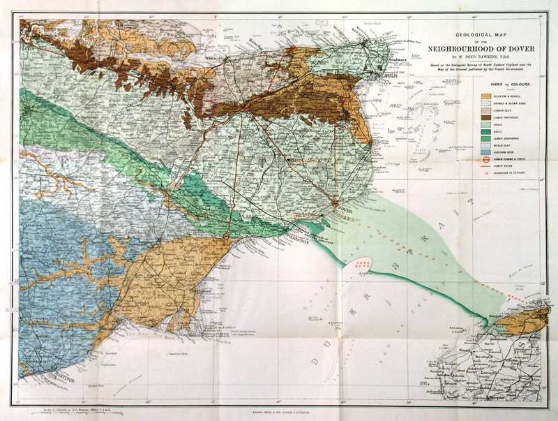
KENT GEOLOGY:582. W. Boyd Dawkins, F.R.S. ĎGEOLOGICAL MAP OF THE NEIGHBOURHOOD OF DOVERí. A detailed folding geological map of the area of East Kent, including part of East Sussex. Not dissected. Published by George Philip & Son, London, ca. 1890 [28204] 35†x†48†cm, folding into original red covers 16†x†11†cm. Printed in full
colour. Excellent condition. £100
|
 |
LIVERPOOL:583. Wyllie, W. L. & H. W. Brewer. ĎBIRDíS - EYE VIEW OF LIVERPOOL, AS SEEN FROM A BALLOON, 1885í. Engraved by W. L. Wyllie and H. W. Brewer for The Graphic 1885 [21541] 56 x 78 cm. Uncoloured as issued. Excellent condition. £200
|
 |
MIDDLESEX:586. Janssonius, J. / Schenk, P. & Valk, G. ĎMIDDELSEXIAE CUM HERTFORDIAE
COMITATU: MIDLESEX & HERTFORD SHIREí. Map of Middlesex and Hertfordshire incl. London north of the Thames and west of the River Lea, north orientated to the right. Three figurative cartouches, coat of arms supported by lion and unicorn. Published by Pieter Schenk and Gerard Valk from the plate by Joannes Janssonius ca. 1700 [21810] 43†x†54†cm. Map in full original
colour, cartouches and shields in full recent colour. Excellent condition. £450
|
 |
|
NEWCASTLE:588. Sulman, T. ĎNEWCASTLE UPON TYNE, 1887í. A really superb view of Newcastle from across the river. Published by the Illustrated London News 1887 [29672]
Uncoloured double page wood engraving, 29 x 55 cm. £120
|
 |
NORWICH:590. Edwads, E. [UNTITLED]. Market Stalls, Norwich. Etching on paper, no title, place, or date, by Edwin Edwards ca. 1870 [26382] 20†x†27.5†cm.
Uncoloured. Slight overall dust soiling, otherwise excellent condition. £100
Edwin Edwards (1823-1879), British painter and engraver. |
 |
|
NOTTINGHAMSHIRE:591. Janssonius, J. / Schenk, P. & Valk, G. ĎCOMITATUS NOTTINGHAMIENSIS SIVE NOTTINGHAMSHIREí. Antique map of Nottingshamshire with two cartouches, 7 coats of arms and heraldic shield with lion and unicorn. Published by Pieter Schenk and Gerard Valk from the plate by Joannes Janssonius ca. 1700 [21819] 37†x†47†cm. Cartouches and coats of arms
uncoloured, the map in full original colour. Excellent condition. £150
|
 |
|
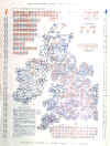
POLITICAL MAP:595. The Graphic. ĎTHE GRAPHIC PARLIAMENTARY MAPí. Showing the counties and boroughs for the Conservative, Liberal and Home Rule Political Parties. The Graphic 1880 [21588] 72 x 51 cm. Coloured in blue pink and red as originally issued. Folded. £75
|
 |
POLITICAL MAP:596. Illustrated London News. ĎA PARLIAMENTARY MAP OF THE UNITED KINGDOM AND IRELANDí. Coloured to show the decision of the nation upon the Home Rule question, 1886. Illustrated London News 1886 [21590] 72 x 52 cm. Coloured in green, light orange and orange as originally issued. Folded. £75
|
 |
POLITICAL MAP:597. Illustrated London News. ĎTHE ILLUSTRATED LONDON NEWS ELECTION MAPí. The electoral battlefield at a glance: Candidates and constituencies. Each constituency is represented by either a circle or octagon. Illustrated London News 1906 [21591] 66 x 52 cm. Coloured in red and blue as originally issued. Folded. £75
|
 |
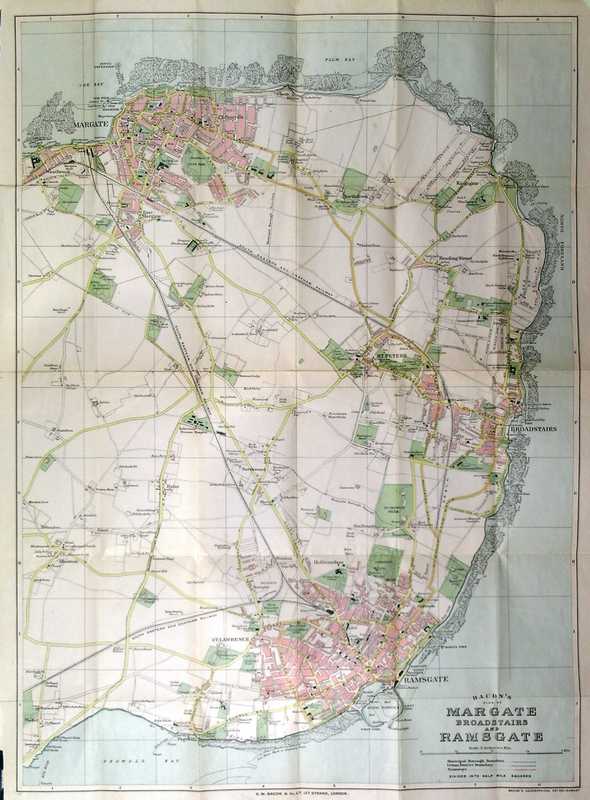
RAMSGATE:599. Bacon, G. W. ĎBACONíS PLAN OF MARGATE, BROADSTAIRS AND RAMSGATEí. Large folding plan, not dissected. G. W. Bacon & Co Ltd., London ca. 1890 [28203] 68†x†50†cm, folding into original red printed covers, 17†x†10†cm. Original
colour. Excellent condition. £120
Street index not present. |
 |
ROMNEY - LYDD - RYE:601. Fricx, E. H. ĎLES COSTES DU BOULENOIS ET LE PAS DE CALAISí. Antique map of the English Channel with eastern parts of Kent (Romney,
Lydd, Rye) and the French coast above Boulogne (Ambleteuse and Cap Gris-Nez). Numerous decorative sailing ships and boats. Eugene Henry Fricx 1709 [22422] 41†x†56†cm. Original outline
colour. Excellent condition. £120
|
 |
|
TUNBRIDGE WELLS:615. Pelton, R. ĎPELTONíS LARGE MAP OF TUNBRIDGE WELLS & NEIGHBOURHOODí. Folding road map of Tunbridge Wells & Neighbourhood Ďon a large scale for driving, walking, cycling, &c.í. Attached is a one page list of ĎPleasant Rides for Cyclistsí with approximate distances between each place. Folding map, not dissected, published by R. Pelton, Tunbridge Wells, ca. 1890 [28205] 60 x 66 cm, folding into pictorial red covers showing horses and cart and cyclists, 19.5†x†13†cm, edges slightly buckled. Uncoloured lithograph, mounted on cloth. Very good condition. £120
|
 |
|
ADMIRALTY SEA CHARTS
|
|
|
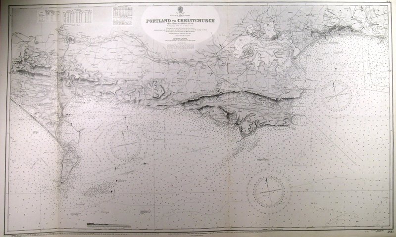
BOURNEMOUTH:617. Admiralty Charts. ĎPORTLAND TO CHRISTCHURCHí. Large sea chart of the South Coast from Weymouth to Bournemouth as surveyed in 1936 and now published with corractions by the Admiralty 1943 [29942] 66†x†111†cm. Uncoloured as issued. Excellent condition. £100
|
 |
CHANNEL ISLANDS:619. Admiralty Charts. ĎGUERNSEY, HERM AND SARKí. Large sea chart of Guernsey, Herm and
Sark, surveyed by F. W. Sidney in 1859/62 and now published with corrections by the Admiralty 1950 [29930] 66†x†106†cm. Uncoloured as issued. Excellent condition. £100
|
 |
CHANNEL ISLANDS:620. Admiralty Charts. ĎISLAND OF JERSEYí. Large sea chart of Jersey as surveyed by J. Richards in 1867 and now published with corrections by the Admiralty 1950 [29932] 67†x†100†cm. Uncoloured as issued. Excellent condition. £100
|
 |
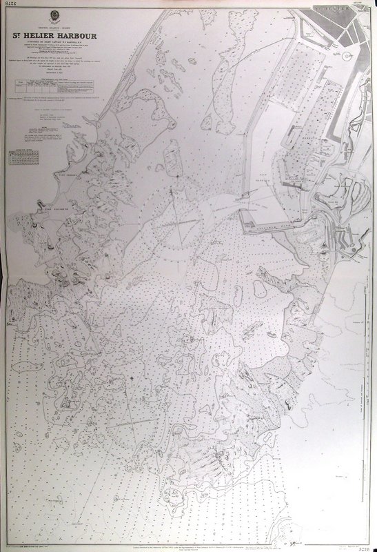
CHANNEL ISLANDS:621. Admiralty Charts. ĎST. HELIER HARBOURí. Large sea chart of St. Helier Harbour on the island of Jersey as surveyed by W. F. Maxwell in 1901 and now published with corrections by the Admiralty 1950 [29933] 100†x†68†cm. Uncoloured as issued. Excellent condition. £100
|
 |
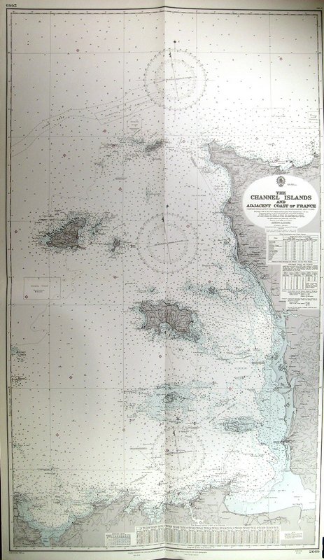
CHANNEL ISLANDS:622. Admiralty Charts. ĎTHE CHANNEL ISLANDS AND ADJACENT COAST OF FRANCEí. Large sea chart of the Channel Islands and the east coast of France, reaching south to St.
Malo, compiled from latest information t0 1951 and published by the Admiralty 1952 [29937] 120†x†70†cm. Uncoloured as issued. Excellent condition. £100
|
 |
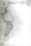
FALMOUTH:627. Admiralty Charts. ĎAPPROACHES TO FALMOUTHí. Large sea chart of Falmouth Bay as surveyed by W. V. Rice in 1925/30 and now published with corrections by the Admiralty 1944 [29949] 98†x†66†cm. Uncoloured as issued. Excellent condition. £100
|
 |
FALMOUTH:628. Admiralty Charts. ĎFALMOUTH HARBOURí Large sea chart of Falmouth Harbour as surveyed by J. D. Nares in 1923. Inset map of the continuation to Truro. Published with corrections by the Admiralty 1946 [29954] 116†x†66†c. Uncoloured as issued. Excellent condition. £100
|
 |
ISLE OF WIGHT:630. Admiralty Charts. ĎCOWES HARBOURí. Large sea chart of Cowes Harbour on the Isle of Wight as surveyed 1936/37 and now published with corrections by the Admiralty 1946 [29934] 100†x†67†cm. Uncoloured as issued. Excellent condition. £150
|
 |
PENZANCE:631. Admiralty Charts. ĎPENZANCE BAYí. Large sea chart of Penzance Bay and
Penzance, reaching to Marazion and Mousehole. Small inset plan of Penzance
Harbour. surveyed by A. G. N. Wyatt in 128 and published with corrections by the Admiralty 1951 [29926] 99†x†66†cm. Uncoloured as issued. Excellent condition. £100
|
 |
PLYMOUTH:632. Admiralty Charts. ĎPLYMOUTH SOUNDí. Large sea chart of Plymouth Sound and parts of southern Plymouth, compiled from surveys to 1940 and published with corrections by the Admiralty 1950 [29923] 66†x†99†cm. Uncoloured as issued. Excellent condition. £150
|
 |
PLYMOUTH:633. Admiralty Charts. ĎCATTEWATERí. Large sea chart of Plymouth Sound with geat detail of Plymouth town as surveyed by E. C. Hardy in 1914 and now published with corrections by the Admiralty 1946 [29945] 66†x†99†cm. Uncoloured as issued. Excellent condition. £175
|
 |
PLYMOUTH:634. Admiralty Charts. ĎPLYMOUTH SOUND AND HAMOAZEí. Very large detailed sea chart of Plymouth Harbour and Plymouth as surveyed by F. Haslewood in 1898/99 and now published with corrections by the Admiralty 1951 [29956] 110†x†73†cm. Uncoloured as issued. Excellent condition. £220
|
 |
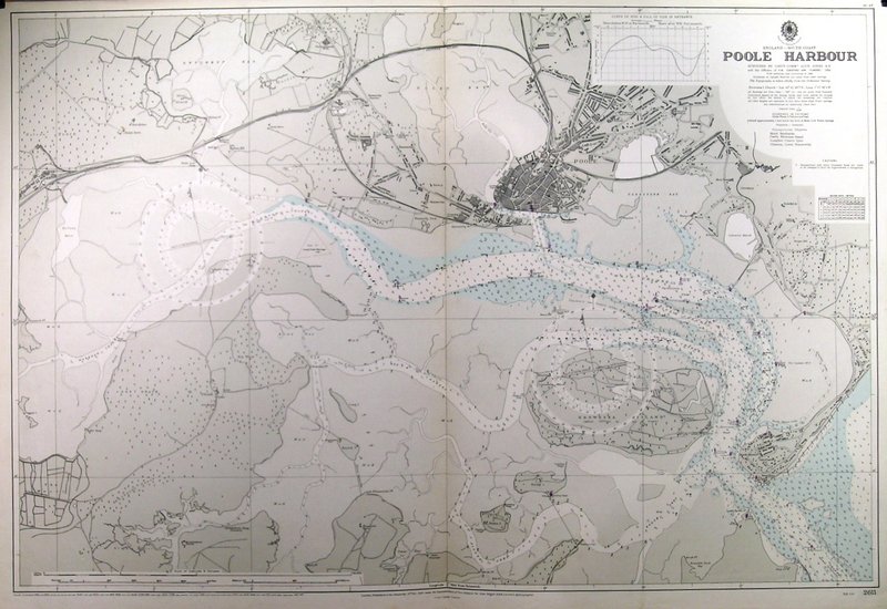
POOLE HARBOUR:636. Admiralty Charts. ĎPOOLE HARBOURí. Large sea chart of Poole
Harbour, including SANDBANKS and near coastal areas as surveyed by Alun Jones 1934 and now published with corrections by the Admiralty 1946 [29941] 66†x†98†cm. Tidal areas printed in pale
colours. Excellent condition. £180
|
 |
SALCOMBE:637. Admiralty Charts. ĎSALCOMBE RIVERí. Sea chart of Salcombe River between the Sea and
Kingsbridge, surveyed by Commander Henry L. Cox 1859. Inset plan of Salcombe
Harbour. First published at the Admiralty 1863 under the Superintendence of R.
Admrl. Washington, and now with small corrections by the Admiralty 1945 [26830] 97†x†63†cm.
Uncoloured. Excellent condition. £175
|
 |
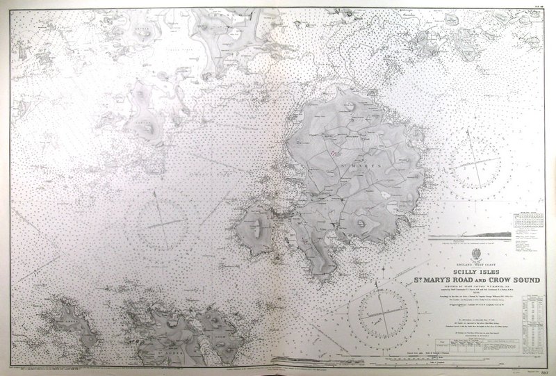
SCILLY ISLES:638. Admiralty Charts. ĎSCILLY ISLES ST. MARYíS ROAD AND CROW SOUNDí. Large dtailed sea chart of the Scilly Isles as surveyed by W. F. Maxwell in 1898 and now published with corrections by the Admiralty 1946 [29948] 66†x†99†cm. Uncoloured as issued. Excellent condition. £150
|
 |
SCILLY ISLES:639. Admiralty Charts. ĎTHE SCILLY ISLESí. Large sea chart of the scilly Isles from surveys by W. F. Maxwell in 1898/1904 and now published with corrections by the Admiralty 1945 [29953] 66†x†99†cm. Uncoloured as issued. Excellent condition. £100
|
 |
SOUTH COAST:640. Admiralty Charts. ĎOWERS TO BEACHY HEADí. Large sea chart of the South Coast between Bognor Regis, Brighton and
Eastbourne. From a survey in 1937 now published with corrections by the Admiralty 1947 [29944] 66†x†117†cm. Uncoloured as issued. Excellent condition. £100
|
 |
TORQUAY:641. Admiralty Charts. ĎTOR BAYí. Large sea chart of Tor Bay with the coastal towns of
Torquay, Paignton and Brixham as surveyed by F. Haslewood in 1904/06. Small inset plan of Torquay
Harbour. Published with corrections by the Admiralty 1944 [29958] 82†x†65†cm. Uncoloured as issued. Excellent condition. £100
|
 |
WEYMOUTH - PORTLAND:642. Admiralty Charts. ĎWEYMOUTH AND PORTLANDí. Large sea chart of Weymouth Bay and Portland as compiled from surveys to 1936 and now published with corrections by the Admiralty 1945 [29961] 99†x†65†cm. Uncoloured as issued. Excellent condition. £100
|
 |