CALAIS and DUNKERQUE:987. Merian, Matthaeus. ‘CALES’, ‘CALAIS’ and ‘DUYNKERKE’. Two views (Calais,
Dunkerque) and one plan (Calais) on one sheet. Engraved by Merian and published by Johann Ludwig Gottfried in Frankfurt 1646 [20041] 20 x 29 cm (in total). Excellent condition. £100
Uncoloured as originally published. |
 |
DIEPPE and ST. MALO:989. Merian, Matthaeus. ‘DIEPE’ and ‘ST. MALO’. Two panoramic views above each other on one sheet. Numerous sailing ships in the
harbours. Engraved by Merian and published by Johann Ludwig Gottfried in Frankfurt 1646 [20042] 11 x 32 and 8 x 32 cm respectively, 21 x 32 in total (image). Excellent condition. The two engravings together £100
Uncoloured as originally published. |
 |
FRANCE:990. Merian, Matthaeus. 'GALLIA. LE ROYAUME DE FRANCE.
FRANCKREYCH'. Map of France. Engraved by Merian and published by Johann Ludwig Gottfried in Frankfurt 1646 [7632] 27 x 36 cm. Title cartouche and three other heraldic cartouches. Excellent condition. £150
Uncoloured as originally published. |
 |
LA ROCHELLE:991. Merian, Matthaeus. ‘LA ROCHELLE’. Birds-eye view/plan of the sea port of La Rochelle on the French Atlantic coast with sailing ships in the
harbour. Explanations from 1 - 31. Engraved by Merian and published by Johann Ludwig Gottfried in Frankfurt 1646 [20048] 29 x 35 cm. Excellent condition. £120
Uncoloured as originally published. |
 |
LORRAINE and SAARLAND:992. Merian, Matthaeus. ‘LOTHARINGIA
DUCATUS; VULGO LORRAINE’. Map of Lorraine with parts of the German
Saarland. Engraved by Merian and published by Johann Ludwig Gottfried in Frankfurt 1646 [20065] 28 x 36 cm. Excellent condition. £100
Uncoloured as originally published. |
 |
LYON:993. Merian, Matthaeus. ‘LYON’. View of Lyon in France from a height. Engraved by Merian and published by Johann Ludwig Gottfried in Frankfurt 1646 [20148] 24 x 34 cm. Excellent condition. £150
Uncoloured as originally published. |
 |
MARSEILLE:994. Merian, Matthaeus. ‘MASSILIA. MARSEILLE’. Panoramic view of the French port from the surrounding hills. Engraved by Merian and published by Johann Ludwig Gottfried in Frankfurt 1646 [20051] 20 x 33 cm. Excellent condition. £120
|
 |
NANCY:995. Merian, Matthaeus. ‘NANCEIUM. NANCY’. Half birds-eye view/plan of Nancy in France, former capital of the Duchy of Lorraine, with title banner and heraldic shield in the sky and table of explanations from 1 - 27. Engraved by Merian and published by Johann Ludwig Gottfried in Frankfurt 1646 [20047] 23 x 35 cm. Excellent condition. £100
Uncoloured as originally published. |
 |
REIMS / Champagne:996. Merian, Matthaeus. ‘REIMS EN CHAMPAGNE’. Half birds-eye view/plan of Reims in the Champagne, most famous wine growing area of France. Engraved by Merian and published by Johann Ludwig Gottfried in Frankfurt 1646 [20045] 21 x 33 cm. Excellent condition. £120
Uncoloured as originally published. |
 |
SENLIS / LIMOGES:997. Merian, Matthaeus. ‘SILVANECTUM. SENLIS’ / ‘LEMOVICUM. LIMOGES’. Two panoramic views of Senlis and Limoges in France, one above the other on one double page. Engraved by Merian and published by Johann Ludwig Gottfried in Frankfurt 1646 [25042] 9 x 31 cm each. Excellent condition. The two together £100
Uncoloured as originally published. |
 |
TROYES / CHALONS-EN-CHAMPAGNE:998. Merian, Matthaeus. ‘TROYE’ / ‘CHAALONS EN CHAMPAIGNE’. 2 panoramic views of
Troyes, a town in the Champagne-Ardenne region of northeastern France, and
Chalons-en-Champagne, situated just below Reims near Epernay. Both areas is known as the Champagne region of France. 2 views, one above the other on one double page. Engraved by Merian and published by Johann Ludwig Gottfried in Frankfurt 1646 [24050] 27 x 35 cm in total. Excellent condition. The two together £100
Uncoloured as originally published. |
 |
BURGUNDY:999. Merian, Matthaeus. ‘UTRIUSQUE
BURGUNDIAE, TUM DUCATUS TUM COMITATUS DESCRIPTIO’. Map of the French Burgundy wine region with large title cartouche and scaler of miles. Engraved by Merian and published by Johann Ludwig Gottfried in Frankfurt 1646 [20066] 27 x 36 cm. Excellent condition. £150
Uncoloured as originally published. |
 |
�ALSACE:1000. Speckel, D. / Homann Heirs. ‘ALSATIA TAM SUPERIOR, QUAM INFERIOR UNA CUM
SUNDGOVIA...’. Map of Alsace, the French wine region on the left bank of the Rhine between Basel, Strasbourg and Wissembourg with pictorial cartouche. Alsace is one of the top white wine regions of France, producing terroir-driven wines with pure fruit expression. They come from seven main grape varieties: Sylvaner, Pinot Blanc, Riesling, Muscat, Pinot Gris, Gewurztraminer and Pinot Noir. Printed on two sheets and joined. Drawn in Homann’s workshop after the designs by Daniel Speckel ca. 1750 [23304] 110 x 42 cm. The map in full original
colour. Printed on two sheets and joined. Excellent condition. £350
Uncommon first issue. Drawn in Homann’s workshop (‘delineata Studio Homannianorum’) after the designs by Strasbourg architect, engineer and mapmaker Daniel Speckel in 1576. Without Homann’s address, so probably published separately. A later edition appeared with the Homann Erben address in 1777. |

 |
|
ARTOIS:1001. Quad, M. ‘ARTESIA...’. Detailed map of the northernmost part of France just below Calais. Johann Bussemacher for Matthias Quad ca. 1600 [21280] 21 x 30 cm. Title cartouche and heraldic shield.
Uncoloured. Excellent condition. £100
|
 |
ARTOIS:1002. Visscher, N. ‘GEOGRAPHICA ARTESIAE COMITATUS TABULA’. Antique map of part of the northeast region of Artois in France, reaching from Calais inland to
Douay, Bapaume and Montreuil. Decorative cartouche with coat of arms and cherubs, and scale of miles. Nicolaas Visscher ca. 1685 [21876] 46 x 56 cm. Full original
colour. Excellent condition. £100
|
 |
ARTOIS:1003. Visscher, N. / Schenk, P. ‘LE COMTÉ D’ARTOIS, ET DES ENVIRONS...’. Detailed large map of the northeast region of Artois in France with the Straits of Dover, reaching to Abbeville, Arras, Lille and
Dunkerque. Cartouche supported by cherubs. Published by Pieter Schenk from the plate by Nicolaas Visscher ca. 1720 [21875] 49 x 70 cm. The map in full original
colour. Excellent condition. £240
|
 |
BORDEAUX - MEDOC:1003A. Keulen, J. van. ‘PASKAART VAN DE GAROMNE OF RIVIER VAN BORDEAUX’. Sea chart of the Medoc
wine growing area and Saintonge area both sides of the Gironde with small inset plan of Bordeaux and irregular inset map of the Dordogne and Garonne confluence. Figurative cartouche. North orientated to the South. Published by Johannes van Keulen in Amsterdam ca. 1682 [29708] 51 x 59 cm. Lower border re-margined. Full contemporary
colour. Very good condition. £500
Koeman IV/p. 380 [82]. |
 |
|
BORDEAUX - MEDOC - GIRONDE:1003B. Vuillemin, A. ‘LA FRANCE’. Detailed map of the region ca. 35 miles around Bordeaux, including Medoc and
Gironde, with half-bird’s-eye view of Bordeaux top right, coat of arms and two portraits of Montesquieu and
Nansouty. From Vuillemin's La France et ses Colonies, published in Paris ca. 1880 [30999]
25 x 21 cm. Full hand colour. Excellent condition. £120
Alexandre Vuillemin (1812-1880) was a prominent 19th century French cartographer and editor based in Paris. |
 |
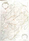
BOURGOGNE - BESANÇON:1005. Jaillot, H. ‘LA COMTÉ DE BOURGOGNE ... / LA FRANCHE COMTÉ DIVISEÉ EN TROIS GRANDS
BALLIAGES...’. Large map of the French Bourgogne region around Besançon, printed on two sheets and joined. Hubert Jaillot 1695 [22393] 80 x 56 cm. Original outline
colour. Excellent condition. £150
|
 |
BREST:1006. Admiralty Charts. ‘CAP DE LA CHÉVRE TO POINTE DE CORSEN INCLUDING RADE DE BREST’. Sea chart of the western French coast around Brest, compiled from French Government Charts to 1921. First published at the Admiralty 1859 under the Superintendence of
Captn. Washington, and now with small corrections by the Admiralty 1958 [26819] 68 x 102 cm.
Uncoloured. Excellent condition. £100
|
 |
BRETAGNE:1007. Valk, G. ‘PRAEFECTURA DUCATUS
BRITANNIAE, QUAE SUPERIOR ET INFERIOR....’. Detailed map of the Bretagne, reaching east to St. Malo and Nantes. Gerard Valk ca. 1700 [22415] 49 x 59 cm. Full original
colour. Excellent condition. £200
|
 |
BRETAGNE:1008. Homann, J. B. ‘TABULA DUCATUS BRITANNIAE GALLIS / LE
GOUVERNEMT. GENERAL DE BRETAGNE...’. Detailed map of the Bretagne region in northwest France with figurative cartouche and small inset plan of Brest, reaching to
Avranches, Angers and Nantes in the east. Johann Baptist Homann ca. 1720 [23863] 48 x 57 cm. Full original
colour, incl. cartouche and plan. Occasional browning in the left white margin. Excellent condition. £200
|
 |
BRETAGNE:1009. Admiralty Charts. ‘FRANCE NORTH COAST SHEET VIII / USHANT TO PLATEAU DES ROCHES DOUVRES’. Large sea chart of the French north coast between Ile d’Ouessant and Les Sept
Iles, compiled from the Pilote Français 1823 with additions and corrections to 1911. First published at the Admiralty 1902 under the Superintendence of Rear Admiral W. J. L. Wharton, and now with small corrections by the Admiralty 1957 [26818] 65 x 127 cm.
Uncoloured. Excellent condition. £100
|
 |
CAMARGUE:1016. Admiralty Charts. ‘SÈTE TO MARSEILLES’. Sea chart of the coast between Sète and Marseille
(Camargue) with a large inset chart of the Port of Sète, compiled from French Government Charts to 1912. First published at the Admiralty 1894 under the Superintendence of Captain W. J. L. Wharton, and now with small corrections by the Admiralty 1957 [26821] 66 x 98 cm.
Uncoloured. Excellent condition. £100
|
 |
CHALON-SUR-SAÔNE:1017. Damme, J. v. / Schenk, P. & Valk, G. ‘LES ENVIRONS DE L’ESTANG DE
LONGPENDU, COMPRENANT UNE GRANDE PARTIE DU COMTÉ DE CHAROLOIS’. Detailed map of the close area west of Chalon-sur-Saône, between Dijon and Lyon. Figurative cartouche and scale of miles. North orientated to the left. Engraved by Abraham van den Broeck and published by Pieter Schenk and Gerard Valk from the plate by the Dutch cartographer Jean van Damme ca. 1700 [22388] 37 x 49 cm. The map in full original
colour. Excellent condition. £150
|
 |
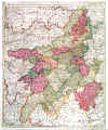
CHAMPAGNE:1018. Valk, L. & G. ‘CAMPANIAE PRAEFECTURA DIVISUM IN ELECTIONES ...’. Antique map of the Champagne region in France between Amiens, Reims and Dijon. Leonard & Gerard Valk ca. 1700 [22391] 59 x 49 cm. Full original
colour. Excellent condition. £150
|
 |
CHAMPAGNE:1019. Aa, P. v. d. ‘CARTE DU GOUVERNEMENT DE CHAMPAGNE, SUIVANT LES NOUVELLES OBSERVATIONS’. Map of the Champagne wine region in central France with pictorial cartouche. Pieter van der Aa, Leiden 1714 [30998]
23 x 30 cm. Recent outline colour, cartouche in full colour. Excellent
condition. £180
Folio edition - no
centrefolds. |
 |
CHERBOURG:1020. Admiralty Charts. ‘CAPE FLAMANVILLE TO ST. MARCOUF IS.’. Detailed sea chart of Cherbourg harbour on the French north coast and its environs, compiled from the latest French Government Charts to 1921. First published by the Admiralty 1888 under the Superintendence of Captain W. J. L. Wharton, and now with small corrections by the Admiralty 1953 [26438] 65 x 98 cm.
Uncoloured. Excellent condition. £100
|
 |
CORSICA:1021. Admiralty Charts. ‘CAPE FENO TO LAVA BAY’. Sea chart of the West coast of Corsica between Ajaccio and Bonifacio from French Government Surveys 1885-90. First published at the Admiralty 1895 under the Superintendence of Rear Admiral W. J. L. Wharton, and now with small corrections by the Admiralty 1957 [26827] 98 x 66 cm.
Uncoloured. Folded twice, otherwise excellent condition. £100
|
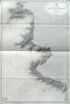 |
CORSICA:1022. Admiralty Charts. ‘LAVA BAY TO CAPE MORSETTA’. Sea chart of the West coast of Corsica between Ajaccio and Calvi from French Government Surveys 1888-90. First published at the Admiralty 1895 under the Superintendence of Rear Admiral W. J. L. Wharton, and now with small corrections by the Admiralty 1957 [26828] 98 x 65 cm.
Uncoloured. Folded twice, otherwise excellent condition. £100
|
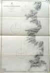 |
CORSICA:1023. Admiralty Charts. ‘PORTS AND ANCHORAGES IN CORSICA’. Sea chart of 14 ports on Corsica, from French Government Charts first published at the Admiralty 1874 under the Superintendence of Captain F. J. Evans, and now with small corrections by the Admiralty 1958 [26815] 61 x 92 cm.
Uncoloured. Folded twice, otherwise excellent condition. £180
Under the depicted ports are
Ajaccio, Bastia, Calvi, Ile Rousse, Porto Vecchio, Port Bonifacio. |
 |
|
DIJON MUSTARD & WINE:1024. Levasseur, V. ‘DEPT. DE LA COTE D’OR’. Map of the area around Dijon, famous for its food, wine and above all its Dijon mustard, surrounded by decorative pictorial scenes of vines and farming. BEAUNE is indicated towards the lower part of the map. Engraved for Victor Levasseur’s Atlas National de la France by Laguillermie and Rainaud ca. 1845 [27694]
29 x 42 cm. Full hand colour. Excellent condition. £175
|
 |
FRANCE:1031. Merian, M. 'GALLIA. LE ROYAUME DE FRANCE.
FRANCKREYCH'. Antique map of France. M. Merian ca. 1646 [7632] 27 x 36 cm. Title cartouche, three heraldic cartouches. Excellent condition. £200
|
 |
FRANCE:1032. De Wit, F. ‘ACCURATISSIMA GALLIAE TABULA’. Antique map of France with figurative cartouche. Frederic de Wit ca. 1680 [22370] 49 x 58 cm. Full original
colour, the cartouche in full original colour. Excellent condition. £100
|
 |
FRANCE:1033. Danckerts, J. ‘ACCURATISSIMA GALLIAE TABULA’. Decorative map of France. Published in Amsterdam by Justus Danckerts ca. 1690 [22369] 49 x 57 cm. Original outline
colour, the cartouche in full original colour. Excellent condition. £150
|
 |
FRANCE:1035. Sanson, N. / Schenk, P. ‘LE ROYAUME DE FRANCE...’. Antique map of France with pictorial cartouche. Published by Pieter Schenk from the plate by Nicolas Sanson ca. 1720 [23278] 48 x 57 cm. The map in full original
colour. Excellent condition. £150
|
 |
FRANCE:1036. Euler, L. ‘TABULA GEOGRAPH:
GALLIAE...’. Antique map of France. Leonhard Euler after J. C. G. Claussen for the Acad. Reg. Scient. et eleg. Litt. Boruss. ca. 1753 [24495] 34 x 39 cm. Full original
colour, cartouche uncoloured. Occasional faint agetoning, otherwise very good condition. Uncommon. £100
Leonhard Euler (Basel 1707 - St. Petersburg 1783), cartographer, physician and mathematician. Published ‘Atlas Geographicus’ for the Prussian Royal Academy of Sciences and Literature in Berlin between 1753 and 1760. - Small printed original Prussian tax/privilege seal as always. |
 |
|
FRENCH ALPS:1037. Schenk, P. & Valk, G. ‘SABAUDIA
DUCATUS. SAVOYE’. Antique map of the French Alps south of Lake Geneva, reaching to Grenoble and Susa near
Torino. Published by Pieter Schenk and Gerard Valk from the plate by Joannes Janssonius ca. 1700 [22286] 37 x 49 cm. Full original
colour, the cartouche uncoloured. Excellent condition. £150
|
 |
GASCOGNE:1038A. Janssonius, J. / Schenk, P. & Valk, G. ‘DESCRIPTION DU GUIENNE’. Antique map of the Gascogne region from the Alantic coast between Bordeaux and Bayonne to Toulouse. North orientated to the left. Published by Pieter Schenk and Gerard Valk from the plate by Joannes Janssonius ca. 1700 [22400] 38 x 51 cm.
The map in full original colour. Excellent condition. £175
|
 |
|
GASCOGNE:1038B. Schenk, P. & Valk, G. ‘LE PAIS DE BEARN’. Map of the area between Bayonne,
Dax, Oloron and Pau in southwest France, bordering Spain. Published by Pieter Schenk and Gerard Valk from the plate by Joannes Janssonius ca. 1700 [22401] 38 x 49 cm. Full original
colour, the cartouche uncoloured. Excellent condition. £175
Named after the rugged mountain range that divides France and Spain, the wines from the Pyre´ne´es sub-region are rustic and
artisanal, crafted from the indigenous Tannat grape variety. Tannat is best known as the dominant grape variety in
Madiran, Southwest France's most famous red wine. The grape probably originated in the Basque country and almost certainly derives its French name from its high tannin levels. It is a thick-skinned grape variety that produces deeply
coloured, well-structured wines. |
 |
GRENOBLE - FRENCH ALPS:1039. Homann, J. B. ‘TABULA DELPHINATUS VULGO LE GOUVERNEMENT GENERAL DU DAUPHINE ...’. Antique map of the French Alps, centred on Grenoble and reaching from Lyon to Provence and
Torino/Italy, with large pictorial cartouche. Johann Baptist Homann ca. 1720 [22378] 48 x 57 cm. Full original
colour, cartouche uncoloured, but lightly browned. Very good condition. £100
|
 |
ILE DE RÉ - ILE D’OLÉRON:1040. Blaeu, W. & J. ‘XAINTONGE ET ANGOUMOIS’. Antique map of the greater area from Ile de Ré, La Rochelle, Ile d’Oléron and Gironde inland to Angoulême. Two figurative cartouches. Willem & Joan Blaeu 1639 [24960] 39 x 50 cm. Latin text verso with contemporary ms annotations. Original outline
colour. Excellent condition. £250
|
 |
ILE DE RÉ - ILE D’OLÉRON:1042. Levasseur, V. ‘DEPT. DE LA CHARENTE
INFRE.’. Antique map of Ile de Ré and Ile d’Oléron on the Franch Atlantic coast, reaching inland to
Aulnay, Cognac and Barbezieux, surrounded by decorative scenery and vignettes of produce and custom of the country. Laguillermie for Levasseur’s Atlas National Illustré ca. 1852 [24962] 42 x 29 cm. The map in original outline
colour. Excellent condition. £100
|
 |
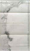
LANGUEDOC:1043. Admiralty Charts. ‘CAPE ST. SEBASTIAN TO SÈTE’. Large sea chart of the coast of Languedoc in southern France and parts of the Spanish coast, compiled from the latest French and Spanish Government Charts. First published at the Admiralty 1894 under the Superintendence of Captain W. J. L. Wharton, and now with small corrections by the Admiralty 1957 [26824] 127 x 66 cm.
Uncoloured. Excellent condition. £100
|
 |
LE MANS:1044. Schenk, P. & Valk, G. ‘DIOCESE DU MANS VULGO LE MAINE, UBI OLIM CENOMANI’. Antique map of the area around Le Mans, the French city best known for its connection with
motorsports. Published by Pieter Schenk and Gerard Valk from the plate by Joannes Janssonius ca. 1700 [22382] 42 x 51 cm. Full original
colour, cartouches uncoloured. Excellent condition. £100
|
 |
LOIRE VALLEY:1045. Valk, G. & L. ‘AURELIANENSIS PRAEFECTURA
GENERALIS...’. Antique map of the whole length of the famous Loire valley from Nantes via Angers, Tours, Orleans and Nevers to St. Etienne. Gerard and Leonard Valk ca. 1702 [22375] 49 x 60 cm. Full original
colour. Excellent condition. £175
|
 |
LORRAINE:1048. Valk, G. ‘GENERALIS LOTHARINGIA DISPARTITA IN DUCATUM EJUS PROPRIUM ET
BARRENSEM...’. Antique map of Lorraine and parts of Alsace in eastern France, bordering the German Saarland with the town of Saarbrücken. Pictorial cartouche. Gerard Valk ca. 1702 [22383] 49 x 59 cm. The map in full original
colour. Excellent condition. £100
|
 |
LORRAINE:1049. Homann, J. B. ‘LOTHARINGIAE TABULA GENERALIS IN QUA DUCATUS LOTHARINGIAE ET BARRI ...’. Antique map of Lorraine in eastern France with Nancy and Metz in the
centre, reaching to Strasbourg and into the German Saarland, with figurative cartouche. Johann Baptist Homann ca. 1720 [22397] 49 x 57 cm. The map in full original
colour. Occasional paperthinning along centrefold, otherwise very good condition. £100
|
 |
LORRAINE - ALSACE:1050A. Danckerts, Th. ‘LOTHARINGIAE ET UTRIUSQUE ALSATIAE IN DITIONES MINORES
DIVISARUM...’. Detailed map of the French region of Lorraine and Alsace, reaching from Strasbourg and the Black Forest to Metz. Theodor Danckerts ca. 1680 [22376] 49 x 57 cm. Full original
colour. Excellent condition. £100
|
 |
|
LOUDON - MIREBEAU:1050B. Schenk, P. & Valk, G. ‘LOUDUNOIS. LAUDUNUM’ and ‘MIREBALAIS’. Two maps of French regions on one sheet, areas around Loudon near Saumur/Loire, and
Mirebeau, south of Loudon. Published by Pieter Schenk and Gerard Valk from the plate by Joannes Janssonius ca. 1700 [22406] 37 x 32 cm and 37 x 15 cm respectively. Full
colour. Excellent condition. £175
The Loire Valley wine region includes the French wine regions situated along the Loire River from the Muscadet region near the city of Nantes on the Atlantic coast to the region of Sancerre and Pouilly-Fumé just southeast of the city of Orléans in north central France. In between are the regions of Anjou, Saumur,
Bourgueil, Chinon, and Vouvray. |
 |
LYON:1051. Merian, M. ‘LYON’. View of Lyon from a height. A fine copy. M. Merian ca. 1646 [20148] 24 x 34 cm.
Uncoloured. Excellent condition. £180
|
 |
LYON:1052. Schenk, P. & Valk, G. ‘LA PRINCIPAUTE DE DOMBES’. Detailed map of the area above Lyon. Published by Pieter Schenk and Gerard Valk from the plate by Joannes Janssonius ca. 1700 [22390] Full original
colour, the cartouches uncoloured. Excellent condition. £100
|
 |
LYON - BEAUJOLAIS:1053. Sanson, N. / Mortier, P. ‘LE GOUVERNEMENT GENERAL DU LYONNOIS COMPRENANT LES PROVINCES DU
LYONNOIS, DU FOREZ ET DU BEAUJOLOIS’. Map of the region north and south of Lyon with large figurative cartouche, printed on two double sheets and joined. This map covers the wine area ‘Maconnais’ to the north of Lyon, producing young red wines made of Gamay Pinot Noir and Pinot Gris and white wines from Chardonnnay and Pinot Blanc grapes. Pouilly Fuisse is the most famous wine appelation. To the south of Lyon are the prestigious wine appellations of Condrieu, Rotie & Chateau Grillet, Hermitage & Crozes Hermitage. Published by Pierre Mortier from the plate by Nicolas Sanson ca. 1700 [22408] 79 x 56 cm. The map in original outline
colour. Excellent condition. £340
The map is is in one large part, but photographed here in two parts.
|

 |
NORMANDY - CHANNEL:1057. Keulen, G. van. ‘NOUVELLE CARTE MARINE CROISSANTE EN DEGRES D’UNE PARTIE DES CÔTES MARITIMES DE
NORMANDIE, VIMEUX, ET PONTIEU...’. Sea chart of the French Channel coast between Dieppe and Le Touquet-Paris-Plage with two compass roses and large decorative cartouche. Published in by Gerard van Keulen in Amsterdam ca. 1709 [29707] 51 x 59 cm. Full contemporary
colour. Very good condition. £250
Gerard Hulst van Keulen was the son of Johannes van Keulen II. Koeman IV/p. 387 [239]. |
 |
PARIS:1060. Janssonius, J. / Schenk, P. & Valk, G. ‘AGER PARISIENSIS VULGO L’ISLE DE FRANCE’. Antique map of the Greater Paris area between
Oise, Seine and Marne. Published by Pieter Schenk and Gerard Valk from the plate by Joannes Janssonius ca. 1700 [22380] 33 x 45 cm. Cartouche with armorial shield and cherubs
(uncoloured), the map in full original colour. Excellent condition. £100
|
 |
PARIS:1061. Homann, J. B. ‘AGRI PARISIENSIS TABULA
PARTICULARIS, QUA MAXIMA PARS INSULAE FRANCIAE...’. Detailed and decorative map of the area about 40km around Paris and Versailles, reaching to Mantes,
Senlis, Melun and Rambouillet. Figurative cartouche. Johann Baptist Homann ca. 1720 [22373] 57 x 48 cm. The map in full original
colour. Excellent condition. £150
|
 |
PARIS:1064. Davies, B. R. ‘PLAN OF PARIS & THE SURROUNDING COMMUNES SHEWING THE FORTIFICATIONS & ALL MODERN IMPROVEMENTS’. Doublepage plan of Paris, reaching clockwise (from the north) to
Clichy, Vincennes, Gentilly and Sevres. Benjamin Rees Davies for Weekly Dispatch Atlas ca. 1860 [25523] 41 x 62 cm.
Uncoloured. Excellent condition. £120
|
 |
PARIS:1066. Garnier. ‘NOUVEAU PARIS MONUMENTAL. ITINERAIRE PRATIQUE DE L’ETRANGER DANS PARIS’. Plan of Paris seen from a half birds-eye position, with numerous vignettes depicting significant buildings. Engraved by L.
Poulmaire, printed by Dufrenoy and published in Paris by Garnier Frères ca.
1920 [24937] 48 x 67 cm. Full original colour. Excellent condition. £250
|
 |
PARIS:1066A. Dutal, F. ‘PARIS MONUMENTAL ET METROPOLITAIN’. Plan of Paris with numerous vignettes depicting significant buildings and Metro lines. Published by F. Dutal in Paris ca. 1920 [28157] 47 x 66 cm. Full original
colour. Excellent condition. £250
Verso ‘Paris et ses Environs’. |
 |
PARIS:1067. Letts, Son & Co. ‘CITY OF PARIS’. Doublepage plan of Paris, printed on two sheets and joined. Letts’s Popular Atlas ca. 1884 [26330] 38 x 58 cm. Printed in
colours. Excellent condition. £80
|
 |
PAS DE CALAIS - ARTOIS:1070. Valk, G. & L. ‘PRAEFECTURA PICCARDIAE ...’. Antique map of northeast France between Calais, Dieppe and Maubeuge on the Belgian border. Gerard & Leonard Valk ca. 1700 [22417] 49 x 59 cm. Full original
colour. Excellent condition. £100
|
 |
POSTAL ROUTES:1072. Homann Heirs. ‘GALLIA POSTARUM GEOGRAPHICE
DESIGNATA.... / CARTE GENERALE DES POSTES DE LA FRANCE’. A general post map of France showing the connections and communications. After Hubert Jaillot published in Nürnberg by Homann Heirs 1745 [22372] 48 x 56 cm. Original outline
colour. Excellent condition. £100
|
 |
PROVENCE:1073. Valk, G. ‘PROVINCIA. SUPREMARUM GALLIAE PRAEFECTURARUM
UNA: VULGARITER GOUVERNEMENT DE PROVENCE....’. Antique map of Provence from Arles to Nice. Gerard Valk ca. 1700 [22384] 49 x 59 cm. The map in full original
colour. Excellent condition. £350
|
 |
PROVENCE:1076. Homann Heirs. ‘LE COMTÉ ET GOUVERNEMENT DE
PROVENCE... / PRAEFECTURA GENERALIS & COMITATUS PROVINCIAE...’. Antique map of the Provence in southern France with two cartouches, the title cartouche showing 40 coats of arms. Homann Heirs ca. 1750 [24106] 47 x 59 cm. Full original
colour, incl. cartouches. Faint brown stain in the top right white margin just outside the image. Excellent condition. £250
|
 |
SOUTHERN FRANCE - LANGUEDOC:1078. Allard, C. ‘LES BASSES SEVENNES DANS LE LANGUEDOC OU LE DIOCESE DE MONTPELLIER DIVISÉ EN NEUF
ARCHIPRETREZ... / DE NEDER SEVENNES IN LANGUEDOC OF ‘T BISDOM VAN MONTPELLIER...’. Detailed map of Languedoc in southern France, the area around Montpellier, showing the boundaries of all the archbishops’ dioceses. Engraved by A. Allard and printed in Amsterdam by Charles Allard ca. 1697 [22616] 42 x 50 cm. The map in full original
colour. Excellent condition. £200
Printed table with 18 column index of placenames in the dioceses in French and Dutch language below. |
 |
|
SOUTHERN FRANCE - LANGUEDOC:1079. Mortier, P. ‘LE THEATRE DE LA GUERRE DANS LES
SEVENNES, LE LANGUEDOC, ET LE PAYS AUX ENVIRONS...’ and ‘PARTIE DES SEVENNES ET LE BAS
VIVARAIS, LE DIOCESE DE MONTPELLIER ET DE NISMES...’. Detailed map on two sheets of southern France and the Mediterranean coast between
Avignon, Montpellier and Narbonne, reaching north to Lyon, showing the boundaries of all the archbishops’ dioceses. Inset map of
Bresse. Pierre Mortier ca. 1700 [22411] 44 x 59 cm each. Original outline
colour. Excellent condition. The set of two maps £300
|

 |
STRASBOURG:1081. Merian, M. ‘DIE STATT STRASSBURG / ARGENTINA’. Half birds-eye view of the town with the fortifications and a few remarkable buildings. M. Merian ca. 1646 [21355] 28 x 36 cm. Heraldic shield and two tables of explanations. Excellent condition. £165
|
 |
STRASBOURG:1082. Janssonius, J. / Schenk, P. & Valk, G. ‘TERRITORIUM ARGENTORATENSE’. Antique map of the area immediate around Strasbourg, reaching East to the Black Forest and
Offenburg, and West to the Ardennes. North orientated to the left. Figurative cartouche and two coats of arms. Published by Pieter Schenk and Gerard Valk from the plate by Joannes Janssonius ca. 1700 [23303] 37 x 49 cm.
The map in full colour. Excellent condition. £175
|
 |
STRASBOURG:1083. Seutter, M. ‘CHOROGRAPHIA ARGENTORATI ALSATIAE METROPOLIS...’. Detailed map of the immediate area 25km around Strasbourg, reaching to Lichtenau and Gengenbach in the East (Baden) and Benfeldt and Saverne in the West (Alsace). Matthaeus Seutter ca. 1730 [24934] 49 x 57 cm. Cartouche
uncoloured, the map in full original colour. Excellent condition. £175
|
 |
STRASBOURG:1084. Seutter, M. ‘STRASBOURG, VILLE ANCIENNE CELEBRE ET TRES FORTIFIEÉ... / STRASBURG, EINE UHRALTE SEHR BERÜHMTE U. NUN AUCH UNGEMEIN FORTIFICIRTE
STATT...’. Large plan of Strasbourg with panorama of the town, flanked by allegorical figures, below. Matthaeus Seutter in Augsburg ca. 1745 [23873] 49 x 57 cm. Full strong original
colour. Excellent condition. £350
|
 |
VERSAILLES:1086. Seutter, M. ‘VERSAILLES CHATEAU DE PLAISANCE LE PLUS DELICIEUX ET LE PLUS
MAGNIFIQUE... / VERSAILLES DAS ANMUTHIG U. PRÄCHTIGSTE LUST-SCHLOSS...’. Magnificent view of the seventeenth century palace and gardens of King Louis XIV, the 'Sun King' and greatest of the Bourbon monarchs, in Versailles near Paris, with crowds of elegantly dressed ladies and gentlemen, many arriving by coaches, to watch a royal procession entering the grounds. Title banner in the sky. Matthaeus Seutter in Augsburg ca. 1730 [24037] 49 x 56 cm. Full original
colour. Excellent condition. £450
|
 |