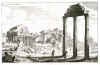
FORUM ROMANUM:1303. Merian, Matthaeus. ‘CAMPO VACCHINA’. View of the Roman Forum. Engraved by Merian and published by Johann Ludwig Gottfried in Frankfurt 1646 [30955] 21 x 33 cm. Excellent condition. £100
Uncoloured as originally published. |
 |
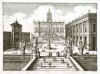
ROME / CAPITOL:1304. Merian, Matthaeus. ‘CAPITOLIUM’. View of Capitol Hill or Campidoglio in Rome. Engraved by Merian and published by Johann Ludwig Gottfried in Frankfurt 1646 [30951] 30 x 36 cm. Excellent condition. £120
Uncoloured as originally published. |
 |
ROMA / CASTEL ST. ANGELO etc:1305. Merian, Matthaeus.
‘CASTELL ST.
ANGELI...’ / ‘S. BARTOLOMEI INSUL...’ / ‘BERG QUIRINALIS...’ / ‘ARCUS SEPTIMII
SEVERI...’. Four views of ancient Rome sights on one double page. Engraved by Merian and published by Johann Ludwig Gottfried in Frankfurt [30956] 25 x 35 cm. Excellent condition. £120
|
 |
MILANO:1306. Merian, Matthaeus. ‘CASTELL ZU MEYLANDT. CASTELLUM MEDIOLANENSE’. Birds-eye view of the moated castle in
Milano. Explanations from 1 - 11. Engraved by Merian and published by Johann Ludwig Gottfried in Frankfurt 1646 [20037] 26 x 23 cm. Excellent condition. £100
Uncoloured as originally published. |
 |
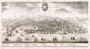
GENOVA:1308. Merian, Matthaeus. ‘GENUA’. Panoramic half birds-eye view of Genova with heraldic shield in the sky and numerous sailing ships in the harbour and the sea. Table of explanations from 1 - 25 below. Engraved by Merian and published by Johann Ludwig Gottfried in Frankfurt 1646 [20023] 21 x 39 cm. Excellent condition. £250
Uncoloured as originally published. |
 |
VENICE:1309. Merian, Matthaeus. ‘L’ALTEA PARTE DELLA PIAZZA DI S. MARCO IN VENETIA’. View of Basilica di San Marco and the Campanile in Venice from the West across a populated St. Marks Square. Engraved by Merian and published by Johann Ludwig Gottfried in Frankfurt 1646 [20026] 21 x 31 cm. Excellent condition. £150
Uncoloured as originally published. |
 |
MANTOVA:1311. Merian, Matthaeus. ‘MANTOVA’. Birds-eye view/plan of Mantova surrounded by lakes. Engraved by Merian and published by Johann Ludwig Gottfried in Frankfurt 1646 [20028] 24 x 35 cm. Excellent condition. £150
Uncoloured as originally published. |
 |
MANTOVA:1312. Merian, Matthaeus. ‘MANTUA DUCATUS’. Map of the country round
Mantova. Engraved by Merian and published by Johann Ludwig Gottfried in Frankfurt 1646 [14900] 28 x 37 cm. Excellent condition. £130
Uncoloured as originally published. |
 |
MESSINA:1314. Merian, Matthaeus. ‘MESSINA’. Half birds-eye view/plan of the Sicilian port. Engraved by Merian and published by Johann Ludwig Gottfried in Frankfurt 1646 [20053] 21 x 35 cm. Excellent condition. £120
|
 |
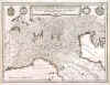
NORTHERN ITALY:1316. Merian, Matthaeus. ‘NOVA ET ACCURATA DUCATUS
VENETIANI, MEDIOLANI, GENUAE, MANTUAE ET FINITIMORUM PRINCIPATUUM DELINEATIO’. Map of Northern Italy, reaching south to Florence, including ‘Stato di Milano’, ‘Dominio di Veneto’ and ‘Liguria’. Engraved by Merian and published by Johann Ludwig Gottfried in Frankfurt 1646 [20069] 27 x 36 cm. Title banner and four coats of arms. Excellent condition. £150
Uncoloured as originally published. |
 |
ITALY:1317. Merian, Matthaeus. ‘NOVA ITALIAE DELINEATIO’. Map of Italy with large cartouche and scale of miles. Shows Sardinia and Corsica and parts of Sicily. Engraved by Merian and published by Johann Ludwig Gottfried in Frankfurt 1646 [20067] 28 x 36 cm. Excellent condition. £200
|
 |
PIEMONTE, LIGURIA & LOMBARDIA:1318. Merian, Matthaeus. ‘PEDEMONTANA REGIO CUM GENUENSIUM TERRITORIO ET MONTISFERRATI MARCHIONATU’. Map of northwest Italy
(Piemonte, Liguria, Lombardia) between Nizza, Val d’Aosta, Milano and
Genova. Engraved by Merian and published by Johann Ludwig Gottfried in Frankfurt 1646 [20140] 28 x 36 cm. Large cartouche. Excellent condition. £150
Uncoloured as originally published. |
 |
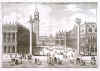
VENICE:1319. Merian, Matthaeus. ‘PIAZZA DE S. MARCO DI VENETIA’. View of the St. Marks Square in Venice from the South with gondolas and the two columns (Colonna di San Marco / Colonna di San
Todaro) in the foreground. Engraved by Merian and published by Johann Ludwig Gottfried in Frankfurt 1646 [20025] 21 x 30 cm. Excellent condition. £300
Uncoloured as originally published. |
 |
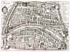
PISA:1320. Merian, Matthaeus. ‘PISA’. Birds-eye view/plan of Pisa in Italy. Explanations from 1 - 17. Engraved by Merian and published by Johann Ludwig Gottfried in Frankfurt 1646 [20027] 19 x 27 cm. Excellent condition. £150
Uncoloured as originally published. |
 |
SOUTHERN ITALY / NAPOLI:1321. Merian, Matthaeus. ‘REGNO DI NAPOLI’. Map of southern Italy with figurative title cartouche, Spanish coat of arms to the top right corner and 6 heraldic shields of southern Italian provinces each to the right and left. Engraved by Merian and published by Johann Ludwig Gottfried in Frankfurt 1646 [30950] 27 x 36 cm. Excellent condition. £150
Uncoloured as originally published. |
 |
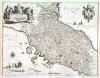
TOSCANA / TUSCANY:1324. Merian, Matthaeus. ‘STATO DELLA
CHIESA, CON LA TOSCANA...’. Map of Tuscany in Italy, reaching from Bologna to Rome. Figurative title cartouche and heraldic shield of Pope Urban VIII (1623-44) with the Barberini bees. Engraved by Merian and published by Johann Ludwig Gottfried in Frankfurt 1646 [30949] 27 x 36 cm. Excellent condition. £200
Uncoloured as originally published. |
 |
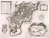
TORINO:1325. Merian, Matthaeus. ‘TURINO’. Castle of Torino with the fortifications. Engraved by Merian and published by Johann Ludwig Gottfried in Frankfurt 1646 [30957] 18 x 25 cm. Excellent condition. £100
Uncoloured as originally published. |
 |
VENICE COUNCIL ELECTIONS:1326. Merian, Matthaeus. [UNTITLED]. Six images on one double page labelled A - E showing the procedure of casting and counting the votes for members of the Venetian Council during the time of the Doges in front of a large chamber of delegates/magistrates. There is a long German key in the text (supplied) of Gottfried’s Newe Archontologia Cosmica to the images, headed ‘Wie die Obrigkeiten und Aempter zu Venedig bestellet
werden...’. Engraved by Merian and published by Johann Ludwig Gottfried in Frankfurt 1646 [30958] 25 x 35 cm. Slight discolouration to the centre fold, otherwise in very good condition. £150
Uncoloured as originally published. |
 |
MALTA:1327. Merian, Matthaeus. ‘VALLETTA CITTA NOVA DI MALTA’. Half birds-eye view of Valletta with title cartouche, table of explanations, large cartouche with map of Malta and
Gozo, compass rose with inset map of Italy and coat of arms. Engraved by Merian and published by Johann Ludwig Gottfried in Frankfurt 1646 [20176] 27 x 35 cm. Excellent condition. £425
Uncoloured as originally published. |
 |
|
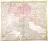
ALPINE REGIONS - NORTHERN ITALY - SWITZERLAND - AUSTRIA:1328. Homann, J. B. ‘DANUBII FLUMINIS .... PARS SUPERIOR, IN QUA
SUEVIA, BAVARIA, AUSTRIA, STIRIA, CARINTHIA, CARNIOLA, TYROLIS ET HELVETIA CUM MAGNA PARTE ITALIAE EXHIBENTUR’. Map of the whole central Alpine region with Northern and Central Italy, Switzerland, Austria, Slowenia and Croatia. Johann Baptist Homann ca. 1720 [22480] 47 x 55 cm. Original
colour. Excellent condition. £100
|
 |
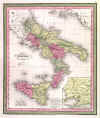
ITALY:1329. Thomas, Cowperthwait & Co. ‘KINGDOM OF NAPLES OR THE TWO SICILIES’. Antique map of southern Italy and Sicily with inset map of the area around Naples. Thomas and Cowperthwait in Philadelphia for Mitchell ca. 1850 [25661] Full original colour with decorative coloured border, 36 x 29 cm. £50
|
 |
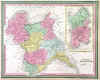
KINGDOM OF SARDINIA:1330. Thomas, Cowperthwait & Co. ‘KINGDOM OF SARDINIA’. Antique map of northwest Italy (Savoy,
Piemonte) with large inset map of the Island of Sardinia. Thomas and Cowperthwait in Philadelphia for Mitchell ca. 1850 [24626] 32 x 40 cm. Full original
colour. Excellent condition. £50
|
 |
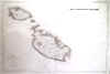
MALTA:1334. Service Hydrographique de la Marine. ‘ILES DE MALTE ET DE GOZO’. Large sea chart of Malta and
Gozo, first published by the Service Hydrographique de la Marine in Paris 1877 after a chart of 1863 by captains Graves and Spratt of the Birish Navy, now published with latest small corrections in Paris in 1973 [26847] 62 x 94 cm.
Uncoloured. Excellent condition. £250
|
 |
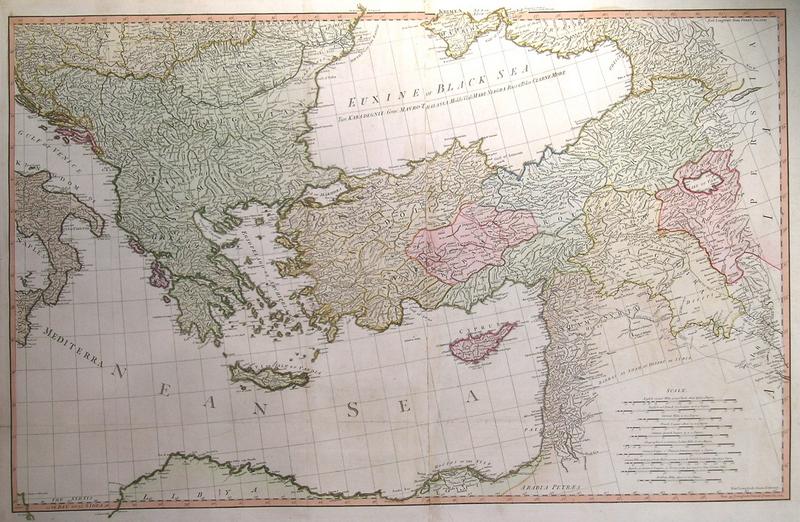
MEDITERRANEAN:1335A. Faden, W. ‘A MAP OF THE MEDITERRANEAN SEA WITH THE ADJACENT REGIONS AND SEAS IN EUROPE, ASIA AND AFRICA’. Very large map of the Mediterranean, printed on four sheets (2 joined), reaching from Spain to the Black Sea and Persia. Published by William Faden 1785 [27868] 59 x 178 cm when joined. Full original
colour. Occasional minor faint browning to joints, otherwise very good condition. £600
|

 |
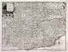
PIEMONTE:1347. Aa, P. v. d. ‘LE PIEMONT, SUIVANT LES NOUVELLES OBSERVATIONS’. Antique map of Piemonte in northern Italy, the region around
Torino, reaching south to the Riviera di Ponente, with pictorial cartouche. Pieter van der Aa, Leiden 1714 [25125] 23 x 30 cm.
Uncoloured. Excellent condition. £120
Folio edition - no
centrefolds. |
 |
|
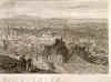
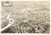
ROME:1356. Little, W. ‘ROME MDCCCXLIX’. Panorama of Rome, from the heights. Wood-engraving issued as a supplement with the Illustrated London News. Drawn by William Little 1849 [24763] 35 x 97 cm. Very good condition.
Uncoloured. £380
|

 |
ROME:1358. Tidmarsh, H. E. & H. W. Brewer. ‘ROME IN 1890’. A superb bird’s-eye view with the Colosseo in the foreground. St Peter’s in the distance. Decorative cartouche. Drawn by H. E. Tidmarsh & H. W. Brewer for The Graphic 1890 [21519] 51 x 75 cm. Folded. Uncoloured as issued. Excellent condition. £200
|
 |
SARDINIA - CORSICA:1360. Dower, J. ‘THE ISLANDS OF CORSICA AND SARDINIA’. Antique map of the French/Italian islands. Engraved for Weekly Dispatch Atlas by John Dower ca. 1863 [25521] 43 x 30 cm. Original outline
colour. Few creases flattened. £100
|
 |
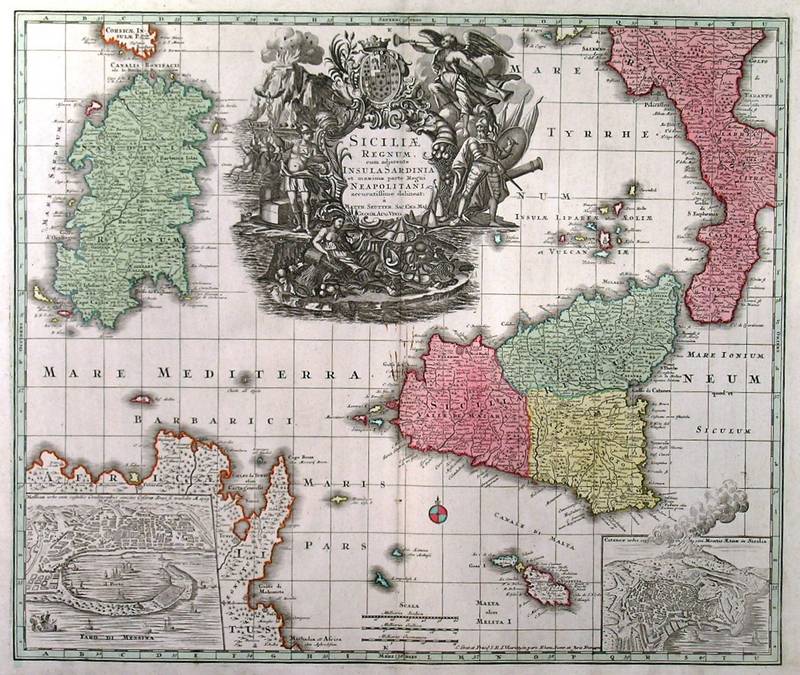
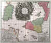
SICILY - SARDINIA:1362A. Seutter, M. ‘SICILIAE REGNUM, CUM ADJACENTE INSULA SARDINIA ET MAXIMA PARTE REGNI
NEAPOLITANI...’. Map of Sicily and Sardinia with very large figurative cartouche and inset plans of Messina and Catania with Mount Aetna. Published by Matthaeus Seutter in Augsburg ca. 1730 [29711] 49 x 58 cm. Cartouche
uncoloured, the map in full original colour. Excellent condition. £350
|
 |
SOUTHERN ITALY:1363. Homann, J. B. ‘NOVISSIMA & EXACTISSIMA TOTIUS REGNI NEAPOLIS
TABULA....’. Antique map of southern Italy, the Kingdom of Naples, with two figurative cartouches incl. cherubs, Neapolitan coat of arms before an erupting Mount
Vesuvius, rider on horseback and a large fish. Johann Baptist Homann ca. 1720 [22346] 56 x 49 cm. Cartouches
uncoloured, the map in full original colour. Very good condition. £275
|
 |
SOUTHERN ITALY:1363A. Seutter, M. ‘NEAPOLIS REGNUM...’. Map of southern Italy, the Kingdom of Naples, with cartouche surrounded by putti and heraldic shields, and scale of miles with two putti holding a heraldic shield and image of Vesuvius above. Published by Mattheus Seutter in Augsburg ca. 1730 [29706] 58 x 50 cm. Cartouches
uncoloured, the map in full original colour. Excellent condition. £375
|
 |
SOUTHERN ITALY:1364. Sanson, N. / Jaillot, H. / Ottens, R. & J. ‘LE ROYAUME DE NAPLES DIVISÉ EN DOUZE PROVINCES’. Antique map of southern Italy, reaching east to Albania and the Greek island of Corfu, with figurative cartouche and scale of miles. Published in Amsterdam by Reinier & Josua Ottens from the plate by Nicolas Sanson / Hubert Jaillot ca. 1740 [22347] 44 x 54 cm. The map in full original
colour. Excellent condition. £100
From the Jaillot-Mortier plate first published in 1696 in the Dutch edition of the Atlas Francois. |
 |
|
SOUTHERN ITALY:1365. Geograph. Institut Weimar. ‘CHARTE VON DEM KÖNIGREICHE
NEAPEL...’. South Italy, excl. Sicily. Ferd. Götze for Verlag des Geograph. Instituts Weimar 1804 [17308] 55 x 43 cm. Full original
colour. Cartouche and scale of miles uncoloured. £100
|
 |
SOUTHERN ITALY:1366. Goetze, F. ‘CHARTE VON DEM KÖNIGREICHE
NEAPEL...’. Antique map of southern Italy. Ferdinand Götze for Verlag des Geograph. Instituts Weimar 1817 [25820] 56 x 43 cm. Original outline
colour. Excellent condition. £100
|
 |
SOUTHERN ITALY:1367. Hall, S. ‘SOUTH ITALY’. South Italy and Sicily. Inset map of Sardinia. Sidney Hall 1828 [19266] 41 x 51 cm. Original outline
Colour. £100
|
 |
TREVISO:1370. Blaeu, J. / Schenk, P. & Valk, G. ‘TERRITORIO TREVIGIANO’. Detailed map of the region around Treviso north of
Venezia, with figurative title cartouche and scale of miles. Published by Pieter Schenk and Gerard Valk from the plate by Joannes Blaeu ca. 1700 [23781] 37 x 47 cm. Full original
colour. Excellent condition. £150
|
 |