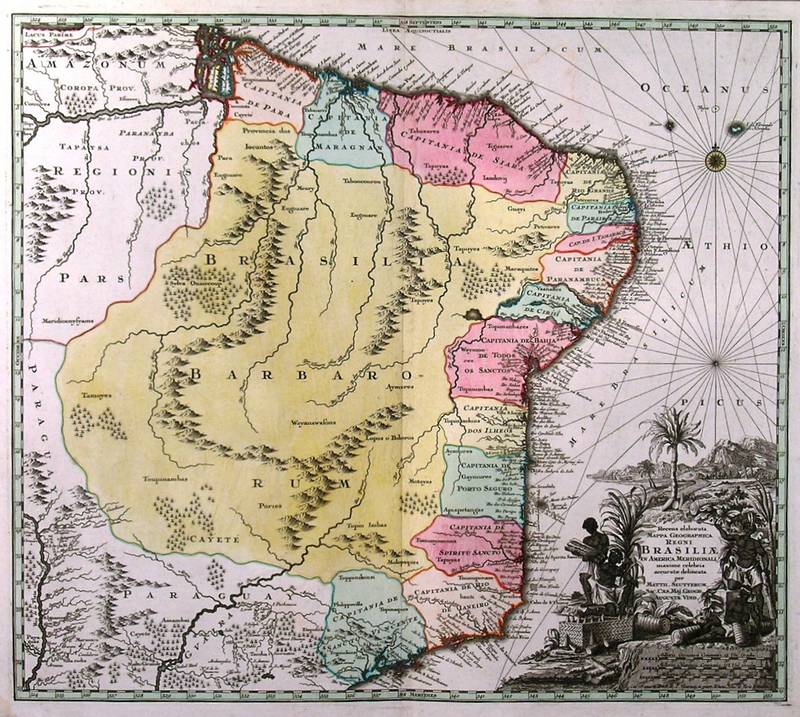
BRAZIL:358. Seutter, M. ĎRECENS ELABORATA MAPPA GEOGRAPHICA REGNI BRASILIAE IN AMERICA
MERIDIONALI...í. Map of Brazil with large figurative cartouche. Published by Matthaeus Seutter in Augsburg ca. 1730 [29714] 49†x†56†cm. Cartouche
uncoloured, the map in full original colour. Excellent condition. £425
|
 |
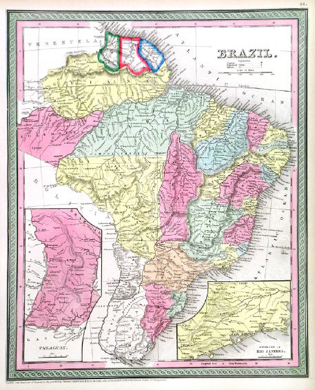
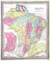
BRAZIL:359. Thomas, Cowperthwait & Co. ĎBRAZILí. Antique map of Brazil with two inset maps of Paraguy and the Environs of Rio de Janeiro. Thomas and Cowperthwait in Philadelphia for Mitchell ca. 1850 [24633] 39†x†31†cm. Full original
colour. Excellent condition. £70
|
 |
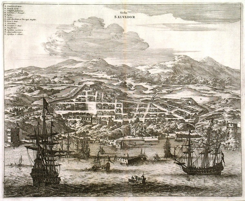
BRAZIL:360. Montanus, A. / Ogilby, J. ĎURBS SALVADORí. Large view of the Brazilian harbour town San Salvador from the sea with numerous warships in the foreground. Arias Montanus / John Ogilby 1671 [18826] 29†x†35†cm.
Uncoloured. Excellent condition. £175
|
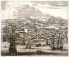 |
BRAZIL:361. Montanus, A. / Ogilby, J. ĎOLINDA DE PHERNAMBUCOí. Large view of
Olinda, a historic coastal town in the Brazilian State of Pernambuco just north of
Recife, with numerous warships in the foreground. Arias Montanus / John Ogilby 1671 [18827] 29†x†35†cm.
Uncoloured. Excellent condition. £175
|
 |
BRAZIL:362. Tallis, J. 'BRAZIL'. Antique map of Brazil. John Tallis ca. 1851 [26483] 34†x†25†cm. Original outline
colour, all vignettes and border recent colour. Excellent condition. Folio edition - no
centrefold. £125
|
 |
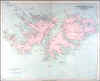
FALKLAND ISLANDS:365. Stanford, E. ĎTHE FALKLAND ISLANDSí. Very detailed large map after a survey by
Captn. Robert Fitzroy, R.N. et al. Edward Stanford ca. 1894 [21051] 49 x†61†cm. Full original
colour. Excellent condition. £120
|
 |
PERU:368. Admiralty Charts. ĎSOUTH AMERICA WEST COAST SHEET XII / PERU AND CHILE / CABO LOBOS TO PUNTA PESCADORESí. Sea chart of the south Peruvian coastline to the Chilean border at
Arica, with 3 inset harbour plans of Puerto de Ilo, Puerto Mollendo and Caleta
Ocona. First published at the Admiralty 1840, and now with a few corrections by the Admiralty 1940 [26435] 48†x†62†cm.
Uncoloured. Excellent condition. £100
|
 |
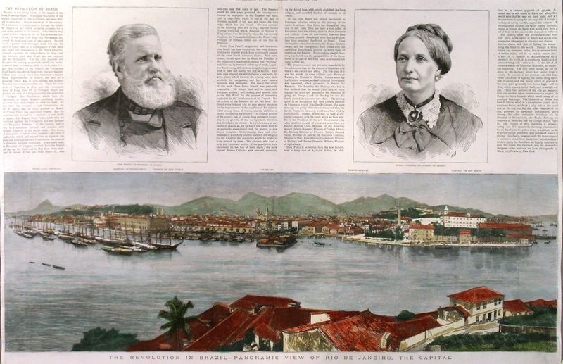
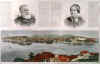
RIO DE JANEIRO:369. Anonymous. ĎTHE REVOLUTION IN BRAZIL - PANORAMIC VIEW OF RIO DE JANEIRO, THE CAPITALí. View taken from across the bay. Sugar Loaf mountain in the far distance. Above text about the revolution and two portraits of Dom Pedro, Ex-Emperor of Brazil, and his wife Donna Theresa. Separately published in London as a supplement to The Graphic 1889 [29716] 36 x 57 cm. The panorama (19†x†57†cm) in full recent
colour. Excellent condition. £150
|
 |
|
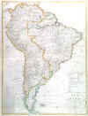
SOUTH AMERICA:372. Faden, W. / De la Rochette, Louis S. díArcy. ĎCOLOMBIA PRIMA OR SOUTH AMERICA...í. Large (wall) map of South America, printed on two double sheets, not joined, Ďdrawn from the large map in eight sheets by Louis Stanislas DíArcy Delarochetteí. Published by William Faden 1811 [27785] 87†x†76†cm, when joined. Original outline
colour. Excellent condition. £450
|

 |
|
SOUTH AMERICA:374. Reichard, C. G. ĎSÜD AMERICA...í. Large map of the South American continent. Christian Gottlieb Reichard for Verlag des Geograph. Instituts Weimar 1817 [25851] 70†x†52†cm. Original outline
colour. Excellent condition. £200
|
 |
SOUTH AMERICA:376. Thomas, Cowperthwait & Co. ĎSOUTH AMERICAí. Antique map of South America. Thomas and Cowperthwait in Philadelphia for Mitchell ca. 1850 [26556] 31†x†38†cm. Full original
colour. Excellent condition. £70
|
 |
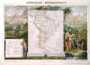
SOUTH AMERICA:377. Levasseur, V. ĎAMÉRIQUE MÉRIDIONALEí. Antique map of South America, set within very decorative scenic pictorial surrounds of natives and animals. Laguillermie for Levasseurís Atlas Universel Illustré ca. 1852 [25796] 28†x†42†cm.
Full hand colour. Excellent condition. £100
|
 |
SURINAM - GUYANA:378. Faden, W. / De la Rochette, Louis S. díArcy. ĎTHE COAST OF GUYANA FROM THE OROONOKO TO THE RIVER OF AMAZONS AND THE INLAND PARTS as far as they have been Explored by the French & Dutch Engineers WITH THE ISLANDS OF BARBADOES TOBAGO &caí. Chart of the
South American coast between Trinidad and the mouths of the Amazon, covering Surinam and French and Dutch Guyana. Four small inset maps. Published by William Faden 1783 [27825] 50†x†68†cm. Original outline
colour. Vertical paper crease near the right margin flattened, otherwise very good condition. £240
A geohydrographic survey by Louis S. De la Rochette Ďfrom the Observations of Captain Edward Thompson made in the Hyaena in the Year 1781...í. |
 |
|