BERGEN:1401. Merian, Matthaeus. ‘BERGEN’. Half bird’s-eye view of Bergen in Norway. Explanations from A - P below. Engraved by Merian and published by Johann Ludwig Gottfried in Frankfurt 1646 [20057] 21 x 31 cm. Excellent condition. £200
Uncoloured as originally published. |
 |
DENMARK:1402. Merian, Matthaeus. ‘DANIA REGNUM’. Map of Denmark and southern Sweden with figurative cartouche and coat of arms. Engraved by Merian and published by Johann Ludwig Gottfried in Frankfurt 1646 [15132] 28 x 34 cm. Excellent condition. £120
Uncoloured as originally published. |
 |
COPENHAGEN:1403. Merian, Matthaeus. ‘HAFNIA METROPOLIS ET PORTUS CELEBERRIMUS
DANIAE. COPPENHAGEN’. Panoramic view of Copenhagen with numerous sailing ships, title banner and small heraldic shield in the sky. Explanations from 1-6 below. Engraved by Merian and published by Johann Ludwig Gottfried in Frankfurt 1646 [20056] 20 x 34 cm. Excellent condition. £175
|
 |
STOCKHOLM:1404. Merian, Matthaeus. ‘STOCKHOLM’. Panoramic view of Stockholm in Sweden with large heraldic shield in the sky. Engraved by Merian and published by Johann Ludwig Gottfried in Frankfurt 1646 [20058] 20 x 33 cm. Excellent condition. £250
Uncoloured as originally published. |
 |
SCANDINAVIA:1405. Merian, Matthaeus. ‘TABULA EXANTISSIMA REGNORU SUECIAE ET
NORVEGIAE...’. Map of Scandinavia incl. Baltic States and Finland. Engraved by Merian and published by Johann Ludwig Gottfried in Frankfurt 1646 [20073] 29 x 36 cm. Large title cartouche. Excellent condition. £150
Uncoloured as originally published. |
 |
�BALTIC SEA:1406. Flemming, C. 'KARTE DER
OST-SEE'. The detailed coastal areas of Denmark, southern Sweden, Finland and the Baltic states. 4 map sheets, joined to form one large map of the Baltic Sea. Inset plans of the areas around Stockholm,
Helsingfors, St.Petersburg, Reval and Frederiksholm. Showing detailed position of the lighthouses all along the coast and on all islands. Handtke for Flemming in Glogau ca. 1850 [7821] 58 x 74 cm. Original outline
colour. Excellent condition. £150
|
 |
DENMARK:1415. Faden, W. ‘A MAP OF THE KINGDOM OF DENMARK WITH THE DUCHY OF HOLSTEIN’. Double page map published by William Faden 1790 [29759]
69 x 52 cm. Full original
colouring. Excellent condition. £120 |
 |
|
DENMARK:1418. Cary, J. ‘A NEW MAP OF THE KINGDOM OF DENMARK, COMPREHENDING NORTH AND SOUTH
JUTLAND, ZEELAND, FYEN, LAALAND, AND PART OF HOLSTEIN...’. Antique map of Denmark. John Cary 1801 [26180] 45 x 51 cm. Full original
colour. Excellent condition. £100
|
 |
SCANDINAVIA:1424. Tesauro, E. ‘LA GRAN PENISOLA DELLA SCANDIA MADRE D’INNUMERABILI
ESSERCITI, E REGALI FAMIGLIE PERTUTTA L’EUROPA DIFFUSE’. Uncommon map of Scandinavia with decorative cartouche and scale of miles, north orientated to the right. Engraved by Antonio de Piene ca. 1664 [24190] 27 x 35 cm.
Uncoloured. Wide margins, excellent condition. £450
From Emmanuele Tesauro's Del Regno d'Italia Sotto i Barbari Epitome, published in Turin 1664. |
 |
|
SCANDINAVIA:1425. Aa, P. v. d. ‘SCANDINAVIE MERIDIONALE OU COURONNES DU
NORD, SUIVANT LES NOUVELLES OBSERVATIONS’. Antique map of southern Scandinavia, Finland, the Baltic Sea and Baltic States with pictorial cartouche. Pieter van der Aa, Leiden 1714 [25060] 23 x 29 cm.
Full hand colour. Excellent condition. £275
Folio edition - no
centrefolds. |
 |
|
SCANDINAVIA:1426. Aa, P. v. d. ‘SCANDINAVIE SEPTENTRIONALE OU COURONNES DU
NORD, SUIVANT LES NOUVELLES OBSERVATIONS’. Antique map of northern Scandinavia and the Nordkapp with pictorial cartouche. Pieter van der Aa, Leiden 1714 [26411] 23 x 29 cm.
Uncoloured. Excellent condition. £180
Folio edition - no
centrefolds. |
 |
|
SCANDINAVIA:1427. Homann, J. B. ‘SCANDINAVIA COMPLECTENS
SUECIAE, DANIAE & NORVEGIAE REGNA’. Joh. Bapt. Homann ca. 1720 [17698] 49 x 58 cm. Full original
colour, large figurative and heraldic cartouche uncoloured. £350
|
 |
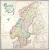
SCANDINAVIA:1429. Geograph. Institut Weimar. ‘CHARTE VON SCHWEDEN UND
NORWEGEN...’. Sweden, Norway and Finland with an inset map of Iceland. J. C. M. Reinecke for Verlag des Geograph. Instituts Weimar 1800 / 1804 [17279] 50 x 49 cm. Full original
colour. Cartouche uncoloured. Excellent condition. £150
|
 |
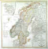
SCANDINAVIA:1430. Reinecke, J. C. ‘CHARTE VON SCHWEDEN UND
NORWEGEN...’. Antique map of Sweden, Norway and Finland with an inset map of Iceland. Johann Christoph Reinecke for Verlag des Geograph. Instituts Weimar 1800 / 1817 [25830] 50 x 49 cm. Original outline
colour. Excellent condition. £150
|
 |
SCANDINAVIA:1432. Lizars, W. ‘SCANDINAVIA INCLUDING SWEDEN, NORWAY & DENMARK’. Doublepage map of Scandinavia with inset map of Iceland. William Lizars ca. 1845 [18981] 48 x 38 cm. Original outline
colour. Excellent condition. £70
|
 |
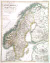
SCANDINAVIA:1433. Stülpnagel, F. v. ‘SCHWEDEN UND NORWEGEN’. Antique map of Sweden and Norway. Small inset map of the environs and plan of Stockholm. Fr. von Stülpnagel for Stieler’s Atlas 1846 [16684] 40 x 32 cm. Original outline
colour. Excellent condition. £75
|
 |
STOCKHOLM - GOETEBORG:1436. (Huldberg, P. A.). ‘KARTA OFVER SEGELLEDEN FRÅN STOCKHOLM KANALVÄGEN TILL GÖTHEBORG JEMTE FYRTIFYRA UTSIGTER’. Large folding strip map of the canal from Stockholm to Göteborg, surrounded by 44 views along the route (incl. two large panoramic views of Stockholm and two of Göteborg). Ny Upplaga (= new edition) Stockholm, Ls. Gust. Rylander ca. 1850 [25963] 238 x 23 cm, folding into original green printed publishers boards (spine split). The map in original outline
colour, the views uncoloured. Excellent condition. £250
The map was originally published without views in 1837, which were added around 1850, and sometimes with a 32-page descriptive text, or alone (as here). |

 |
|
SWEDEN:1437. Visscher, N. ‘HALLANDIA NOVA ET ACCURATA DESCRIPTIO’. Detailed map of Halland on the West coast of Sweden between Göteborg and
Helsingborg. Nicolaas Visscher ca. 1650 [22193] 44 x 52 cm. Figurative cartouche and scale of miles.
Uncoloured. Excellent condition. 450
This is an apparently unrecorded Visscher map, separately published, not appearing in any of the Visscher atlases. The map is identical to an Allard map of the same title. Koeman lists a Covens & Mortier composite atlas (C&M 11/488) which contains a map with the title “Hallandia apud Covens & Mortier”, and the Library of Congress has a nine volume Covens & Mortier atlas (#3448 Vol.3/73) with a “Hallandia Nova et Accurata Descriptio” map without the Visscher address below the title. - A rare map, and one of the few devoted to Halland and north
Schonen, held as Danish until 1645 when it was claimed by Sweden. |
 |