JERUSALEM:393. Merian, Matthaeus. ‘IERUSALEM’. Panoramic view of Jerusalem with explanations from 1 - 24 below. Engraved by Merian and published by Johann Ludwig Gottfried in Frankfurt 1646 [20031] 21 x 34 cm. Excellent condition. £250
Uncoloured as originally published. |
 |
�CYPRUS:394. Stanford, E. ‘CYPRUS’. A large detailed map of the Island of Cyprus at the very beginning of the 20th century. Scale: Five and a half English miles to one inch. A railway line has been laid between Famagusta and Nicosia, then continuing further west to the town of
Morphou. Christian villages and Muslim villages are seperately indicated. Edward Stanford ca. 1896 [26537] 46 x 61 cm. Full original
colour. Excellent condition. £180
Stylianou 224. |
 |
|
JERUSALEM:395. Fleischmann, A. C. ‘EIGENTLICHE VORSTELLUNG DER STATT JERUSALEM UND DERSELBEN UMLIEGENDEN GEGENDEN ZU SALOMONIS ... ZEITEN’. Birds-eye view/plan of Jerusalem at the time of King Salomon with cartouche and table of explanations in German. Engraved by August Christian Fleischmann in Nuremberg ca. 1736 [23786] 35 x 40 cm.
Uncoloured. Excellent condition. £180
From a German Bible by Martin Luther. There are later editions of this map omitting the engraver’s name. |
 |
ISRAEL - PALESTINE:396. Sanson, N. / Jaillot, H. ‘JUDAEA SEU TERRA SANCTA QUAE HEBRAEORUM SIVE ISRAELITARUM TERRA, IN SUAS DUODECIM TRIBUS
DIVISA.....’. Large map of Israel, divided into tribes, with two large decorative cartouches (title and scale of miles). Published by Hubert Jaillot from the plate by‘ Nicolas Sanson 1691 [22125] 56 x 83 cm. Original outline
colour. Previously folded. Excellent condition. £390
This is the much larger and more uncommon version of Jaillot’s Palestine map. Jaillot often published these maps separately. - Short tear to lower margin sometime verso
rebacked. |
 |
|
ISRAEL - PALESTINE:397. Sanson, G. ‘JUDAEA SEU TERRA SANCTA QUAE HEBRAEORUM SIVE ISRAELITARUM IN SUAS DUODECIM TRIBUS DIVISA’. Map of Israel, showing the location of the various tribes, with uncoloured large figurative cartouche and figurative scale of miles. Gulielmi Sanson Nicolai ca. 1700 [23779] 49 x 58 cm. The map in full original
colour. Very good condition. £200
|
 |
|
ISRAEL - PALESTINE:398. Bowen, E. ‘AN ACCURATE MAP OF THE HOLY LAND DIVIDED INTO THE XII TRIBES OF ISRAEL...’. Antique map of Palestine with large cartouche. Emanuel Bowen ca. 1766 [26805] 32 x 23 cm. Recent outline
colour. Excellent condition. £170
|
 |
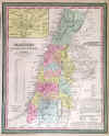
ISRAEL - PALESTINE:399. Thomas, Cowperthwait & Co. ‘PALESTINE & ADJACENT COUNTRIES’. Antique map of Israel and Lebanon with inset map of the environs of Jerusalem. Thomas and Cowperthwait in Philadelphia for Mitchell ca. 1850 [24667] 40 x 32 cm. Full original
colour. Excellent condition. £75
|
 |
|